Hike at a Glance
Max elevation: 564m
Min elevation: 351m
Total Ascent: 469m
Hike overview
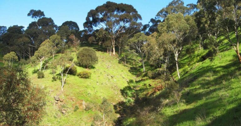
Immerse yourself in history and nature with a visit to Horsnell Gully and Giles Conservation Park. This 8.7km loop trail, rated as moderate difficulty (grade 3), takes approximately 3.5 hours to complete and winds through a scenic valley rich in history and wildlife.
The area holds remnants of a settlement established in the 1840s by Charles Giles and John Horsnell. Look out for the ruins of three stone cottages – "Hope," "Faith," and "Charity" – built from local stone and featuring distinctive lined floors. These stand as testaments to a bygone era.
Near the junction of two creeks, you'll find traces of "The Reedbeds," an area once cultivated by families of gardeners who resided in the cottages. While the layout of the Reedbeds itself may not be readily apparent, remnants of slate channels and the presence of European trees hint at its former purpose.
Keep your eyes peeled for koalas, both in the vicinity of the ruins and as you descend into the valley. The park is known for its koala population, offering a chance to spot these fascinating creatures in their natural habitat.
Gallery
Got some great shots from this hike? Upload your photos here to inspire others and show off the beauty of the trail!
Click to view form >>
Submitting your photos doesn’t mean you lose ownership. You can be credited for your contributions, and you can request removal at any time.
Content use
Please don’t copy GPX files or content from this site to AllTrails or other platforms. Each trail has been personally mapped, documented, and refined to support Australia’s bushwalking and hiking community. While some details come from land managers, every listing reflects significant personal effort. This is a free, community-driven initiative—your respect helps keep it that way.
Walk map and GPX file
Max elevation: 564 m
Min elevation: 351 m
Total climbing: 469 m
Total descent: -469 m
Getting there
Getting to the trailhead: Horsnell Gully Conservation Park, Giles Conservation Park.
Nestled amidst the Adelaide Hills, Horsnell Gully and Giles Conservation Parks offer a scenic escape roughly 10 kilometres east of Adelaide. To reach the trailhead by car, start by heading east on Wakefield Road towards the city centre. Follow Wakefield Road as it becomes Kensington Road, then turn right onto Penfold Road and continue onto The Parade. Take Connell Road and turn right onto Old Norton Summit Road, following it until you reach Coach Road. The trailhead awaits at the end of Coach Road, where you’ll also find parking for your exploration.
Closest towns to this walk: Aldgate, Ashton, Auldana, Bridgewater, Crafers, Leawood Gardens, Norton Summit, Skye, Stirling, Summerton, Teringie, Upper Sturt
About the region
Take a bushwalk through the steep gullies in the picturesque Adelaide Hills to discover the history of Horsnell Gully and Giles Conservation Parks. Both the Heysen and Yurrebilla trails wind their way through these parks, offering stunning views of the surrounding region.
Named after the state Governor's coachmen, John Horsnell, relics and reminders of the Horsnell family property still remain. Along the signposted walking trails, you will find the remains of a large homestead, including the coaching sheds, stable and cowsheds. The original garden of the Horsnell property is located at the start of the walking trail, marked by elm trees, plum trees and orange trees.
There is an extensive network of trails within both parks, with two main hiking loops in Horsnell Gully Conservation Park.
Similar walks nearby
Looking for more walks in or near Horsnell Gully Conservation Park, Giles Conservation Park? Try these trails with a similar difficulty grade.
Track grade
Grade 3 (Moderate) - Walks for Most Fitness Levels: Grade 3 on the AWTGS represents moderate walking tracks. These are ideal for walkers with some fitness who are comfortable with some hills and uneven terrain. While suitable for most ages, some bushwalking experience is recommended to ensure a safe and enjoyable experience. Tracks may have short, steep hill sections, a rough surface, and many steps. The total distance of a Grade 3 walk can be up to 20 kilometers.
Explore safe
Plan ahead and hike safely! Carry enough water, pack layers for changing conditions, and bring safety gear like a torch, PLB, and reliable communication device. Check official sources for trail updates, closures, and access requirements, and review local weather and bushfire advice. Most importantly, share your plans with someone before you go. Being prepared makes for a safer and more enjoyable hike! Stay Safe, Explore More, and Always #ExploreSafe.
Packing checklists
What you carry in your pack depends on factors like weather, terrain, and your adventure type. Not sure what to bring? My free planning, food, and packing checklists are a great starting point, covering day hikes, overnight trips, and multi-day adventures. Use them to customise your kit and always prioritise safety.
Let someone know
Before heading out, take a moment to fill out your trip intentions form. It’s a quick way to share your hike details with family or friends. If something goes wrong, they can notify emergency services, ensuring a faster response and peace of mind. Stay safe and enjoy your adventure
Suggest an edit
Spotted a change on this trail? Maybe there are new features, the route has shifted, or the trail is permanently closed. Whatever the update, I’d love your input. Your feedback helps fellow hikers stay informed and ensures that our trail info stays fresh and reliable.
Acknowledgement of Country
Trail Hiking Australia acknowledges the Traditional Owners of the lands on which we hike and pay respects to their Elders, past and present, and we acknowledge the First Nations people of other communities who may be here today.


11 Reviews on “Horsnell Gully & Giles Conservation Park Hike (8.7km)”
Neil Teasdale, we should
So many kangaroo trails there.one of my fav parks
that is Sunday set