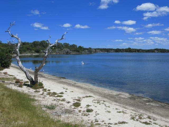
Hill Springs walk is a 500m return walk to the ruins of the historic Hill Springs. The views from the lookout over the Recherche Archipelago and behind to Mount Arid are spectacular.
Built in 1905 by John Baesjou, Hill Springs was occupied by his family until 1910. The trail also visits the grave of William Ponton, John's uncle through marriage. The start of the walk from the Car Park can often be overgrown with ferns and watch out for ticks along the walk. Walk trail surface consists of natural pavements made up of rock material including exposed granite and gravel. The trail is unmarked but vegetation has been cleared to delineate the path.
Start Point: Cape Arid National Park, Thomas Fishery Track off Posion Creek Road 160km (2hours) east of Esperance which is 700km SE of Perth
End Point: Cape Arid National Park, Thomas Fishery Track off Posion Creek Road 160km (2hours) east of Esperance which is 700km SE of Perth
Region: Cape Arid National Park, Golden Outback
For more information, a location map and GPS file please visit Trails WA.
Got some great shots from this hike? Upload your photos here to inspire others and show off the beauty of the trail!
Submitting your photos doesn’t mean you lose ownership. You can be credited for your contributions, and you can request removal at any time.
Please don’t copy GPX files or content from this site to AllTrails or other platforms. Each trail has been personally mapped, documented, and refined to support Australia’s bushwalking and hiking community. While some details come from land managers, every listing reflects significant personal effort. This is a free, community-driven initiative—your respect helps keep it that way.
It looks like I don’t have a GPX file for this trail yet. If you have one to share, please email it to me! I’ll verify it against official maps before adding it to help other hikers have a safer, easier experience. Thanks for contributing to a better hiking resource.
Getting there
Getting to the trailhead: Cape Arid National Park.
Closest towns to this walk: Cape Le Grand, Condingup, Esperance, Munglinup, Nornalup, Ravensthorpe, Salmon Gums, Salmon Gums Balladonia, Scaddan Balladonia
About the region
Cape Arid National Park is a wildly beautiful and biodiverse area. Coastal sandheaths, mallee and low granite hills extend inland to Mount Ragged after which the vegetation is transformed into woodlands dominated by saltbush and bluebush. The jagged Russell Range, which rises to its highest point at Tower Peak (almost 600m), comprises ancient uplifted quartzite that has the same origins as the Barrens Range in Fitzgerald River National Park.
Similar walks nearby
Looking for more walks in or near Cape Arid National Park? Try these trails with a similar difficulty grade.
Favourite

Woody Lake Nature Reserve
Favourite

Fitzgerald River National Park
Favourite

East Fitzgerald National Park
Favourite

Fitzgerald River National Park
Track grade
Grade 2 (Easy) - A Gentle Introduction to Inclines: Grade 2 on the
AWTGS represents easy walking tracks that offer a slightly more challenging experience compared to Grade 1. Similar to Grade 1, no prior bushwalking experience is required. The track surface is typically hardened or compacted and may have gentle hill sections or occasional steps. The total distance of a Grade 2 walk is typically no greater than 10 kilometers. These walks are still suitable for families with a bit more experience or those seeking a gentle introduction to some inclines.
Explore safe
Plan ahead and hike safely! Carry enough water, pack layers for changing conditions, and bring safety gear like a torch, PLB, and reliable communication device. Check official sources for trail updates, closures, and access requirements, and review local weather and bushfire advice. Most importantly, share your plans with someone before you go. Being prepared makes for a safer and more enjoyable hike! Stay Safe, Explore More, and Always #ExploreSafe.
Packing checklists
What you carry in your pack depends on factors like weather, terrain, and your adventure type. Not sure what to bring? My free planning, food, and packing checklists are a great starting point, covering day hikes, overnight trips, and multi-day adventures. Use them to customise your kit and always prioritise safety.
Let someone know
Before heading out, take a moment to fill out your trip intentions form. It’s a quick way to share your hike details with family or friends. If something goes wrong, they can notify emergency services, ensuring a faster response and peace of mind. Stay safe and enjoy your adventure
Suggest an edit
Spotted a change on this trail? Maybe there are new features, the route has shifted, or the trail is permanently closed. Whatever the update, I’d love your input. Your feedback helps fellow hikers stay informed and ensures that our trail info stays fresh and reliable.


