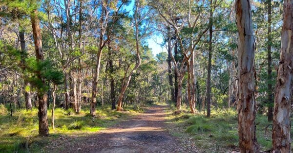
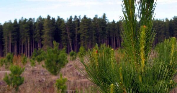
The Nurragi Conservation Reserve Walking Trail offers a unique opportunity to explore a vital wildlife corridor while following a historic route. This 14km (one-way) grade 3 hike traverses the former railway line that once connected Milang to Sandergrove. Opened in 1884 and decommissioned in 1970, the railway line was converted into a conservation reserve in 1991.
The trail plays a significant role in connecting the eastern Mount Lofty Ranges with Lake Alexandrina, providing a safe haven and passage for various bird species. The region surrounding the reserve has seen a dramatic loss of native vegetation, with over 98% cleared. Nurragi Conservation Reserve stands as a refuge for over 300 indigenous plant species, with more than 50 holding regional conservation significance.
While the official trailhead starts near the wetlands at the Port Milang Historic Railway Museum, a more convenient access point is located on McDonald Street. For a more scenic option, you can begin your walk at the Milang Regatta Club and follow the Wetlands Walking Trail past the museum before connecting to the main trail on McDonald Street.
If you're looking for a shorter option, consider an 8km return trip to the former Nurragi Railway Station. However, the full 14km one-way route offers a more immersive experience into this historically and ecologically significant area.
For more information on this hiking trail, please visit Walking SA
Grade 3 (Moderate) - Walks for Most Fitness Levels: Grade 3 on the
AWTGS represents moderate walking tracks. These are ideal for walkers with some fitness who are comfortable with some hills and uneven terrain. While suitable for most ages, some bushwalking experience is recommended to ensure a safe and enjoyable experience. Tracks may have short, steep hill sections, a rough surface, and many steps. The total distance of a Grade 3 walk can be up to 20 kilometers.
Total distance: 14296 m
Max elevation: 44 m
Min elevation: 3 m
Total climbing: 17 m
Total descent: -57 m
Content use
Please don’t copy GPX files or content from this site to AllTrails or other platforms. Each trail has been personally mapped, documented, and refined to support Australia’s bushwalking and hiking community. While some details come from land managers, every listing reflects significant personal effort. This is a free, community-driven initiative—your respect helps keep it that way.
Gallery
Got any photos from this hike? Your photos can help others plan. Share shots from along the trail so fellow hikers know what to expect.
Click to add your photos >>
Getting there
Getting to the trailhead: Nurragi Conservation Reserve.
Situated just outside Milang in South Australia, the reserve is easily accessible by car. If you’re travelling from Adelaide, head east on the Princes Highway (M1) for approximately 90 kilometres. Take the Langhorne Creek exit and follow Langhorne Creek Road until you turn right onto Lake Road. Continue onto Daranda Terrace, and the reserve entrance will be on your left on McDonald Street.
Need a rental car to get you to the hike? Find one here.
Let someone know
Heading out? Fill in a trip intentions form so someone knows your plans. If things go wrong, they can raise the alarm fast, giving you peace of mind on the trail.
About the region
Nestled just outside the town of Milang in South Australia, Nurragi Conservation Reserve offers a haven for nature lovers and a refuge for native flora and fauna. This vital wildlife corridor plays a crucial role in connecting the eastern Mount Lofty Ranges with Lake Alexandrina, providing a safe passage and habitat for various bird species.
More than 98% of the surrounding agricultural region has seen a loss of native vegetation, making Nurragi even more significant. The reserve serves as a sanctuary for over 300 indigenous plant species, with more than 30% holding regional importance. Visitors can explore this diverse ecosystem through a well-maintained nature trail, ideal for hiking and bushwalking. Spring and early summer boast the most vibrant wildflower displays, making it a particularly picturesque time to visit.
Similar walks nearby
Looking for more walks in or near Nurragi Conservation Reserve? Try these trails with a similar difficulty grade.
Favourite

Favourite

Favourite

Favourite

Explore safe
Plan ahead and hike safely! Carry enough water, pack layers for changing conditions, and bring safety gear like a torch, PLB, and reliable communication device. Check official sources for trail updates, closures, and access requirements, and review local weather and bushfire advice. Most importantly, share your plans with someone before you go. Being prepared makes for a safer and more enjoyable hike! Stay Safe, Explore More, and Always #ExploreSafe.
Packing checklists
What you carry in your pack depends on factors like weather, terrain, and your adventure type. Not sure what to bring? My free planning, food, and packing checklists are a great starting point, covering day hikes, overnight trips, and multi-day adventures. Use them to customise your kit and always prioritise safety.
Suggest an edit
Notice something different about this trail? Whether it’s a new feature, a route change, or a closure, share your update so we can keep our info accurate and helpful for fellow hikers.
Click to suggest edits >>


