Trail Fast Facts
Fernleigh Track - Adamstown to Belmont Rail Trail is a 16km, grade 3 hike in Newcastle, New South Wales. This hike typically takes 5 hours to complete.
Warning
This hike is classified as Grade 3 (Moderate) primarily due to its distance exceeding 10km. The terrain itself is relatively easy and suitable for most abilities. However, the longer distance requires some stamina. Feel free to turn back at any point for a shorter adventure.
Hike Overview
Adamstown - railway station
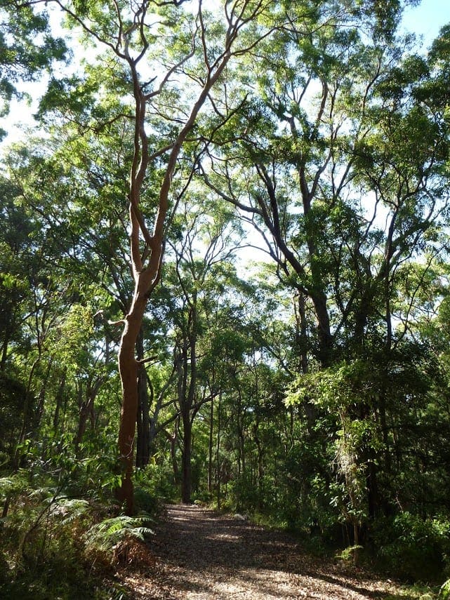
A high quality rail trail through a range of landscapes from suburbia to dense bushland.
The rail trail is gently graded.
All busy road crossings have facilities to cross safely.
A major feature is the 180m long curved brick lined tunnel under the Pacific Highway.
Considerable effort has gone into preserving the history of the corridor with rail track being left in place where practical, and removed rail and sleepers used for features along the trail.
This section is basically flat and the scenery predominantly coastal bushland, the highlight being the boardwalk across wetlands. The platform and surrounds at Belmont have had considerable landscaping making it quite a feature.
Belmont is the best place along the trail to buy refreshments having a large range of place to eat and drink.
Track Grade
Grade 3 (Moderate) - Walks for Most Fitness Levels: Grade 3 on the AWTGS represents moderate walking tracks. These are ideal for walkers with some fitness who are comfortable with some hills and uneven terrain. While suitable for most ages, some bushwalking experience is recommended to ensure a safe and enjoyable experience. Tracks may have short, steep hill sections, a rough surface, and many steps. The total distance of a Grade 3 walk can be up to 20 kilometers.
Tips
Adamstown to Belmont in Newcastle Area
Near Newcastle , 160km from Sydney
Sealed
Undulating
Photo credit: Rail Trails Australia. For more information and a location map please visit RailTrails Australia.
Map and GPX file
Help fellow hikers navigate with confidence. Share your GPX or KML file for this trail and help build a more comprehensive resource with precise waypoints and elevation profiles. Your contribution will empower adventurers with details they need for a safer and more enjoyable experience. I meticulously verify every file using official maps and surveys, ensuring the highest level of accuracy and reliability. Submit your file now and become a trailblazer for your fellow outdoor enthusiasts.
Trail Location (trailhead)
Sorry, no records were found. Please adjust your search criteria and try again.
Sorry, unable to load the Maps API.
Photo gallery
If you have any photos from this hike and are happy to share them, please upload your .jpg files here.
Please note: Uploading photos does not transfer ownership of copyright away from you. If requested, you will be credited for any photos you provide and can ask they be deleted at any time.
About the region
Situated on the east coast of NSW, Newcastle is surrounded by golden sand beaches, a breathtaking coastline and a beautiful working harbour. The cafes, restaurants and bars, unique architecture and rich history stretch from the city to the suburbs.
Similar trails nearby
Explore Safe
While planning your hike, it’s important to check official government sources for updated information, temporary closures and trail access requirements. Before hitting the trail, check local weather and bushfire advice for planned burns and bushfire warnings and let someone know before you go. Plan ahead and hike safely.
Let someone know
Adventure with peace of mind: Fill out your trip intentions form. Before you hit the trail, fill out an online form to privately send important details about your hike to your family or friends. If you don’t return on time, they can easily alert emergency services, preventing worry and ensuring a swift response. Hike with peace of mind and enjoy your outdoor adventure to the fullest. Be smart, be safe: Register your plans here.
Gear to consider
What you carry in your pack will depend on the weather, terrain, time of year, type of adventure, and personal preferences. Having trouble deciding what gear’s right for you? My free planning, food and packing checklists provide an introduction to things your could consider (as well as the Ten Essentials) on your day, overnight and multi-day adventures. Customise your kit according to your personal needs, always considering safety first.
Suggest an edit
Trail changed? New features discovered? Has the route changed? Trail permanently closed? Help fellow hikers by suggesting edits! Click above to update route descriptions, GPX file, trail features (like boardwalks), or access conditions (like parking availability). Help me keep the trails info fresh!
Weather
Acknowledgement of Country
Trail Hiking Australia acknowledges the Traditional Owners of the lands on which we hike and pay respects to their Elders, past and present, and we acknowledge the First Nations people of other communities who may be here today.


3 Reviews on “Fernleigh Track - Adamstown to Belmont Rail Trail (16km)”
Great ride, especially for younger kids as it’s relatively flat. Would recommend starting at Belmont if doing this route with children and returning the same way back to the car. Nice cafe just before Adamstown.
Track notes: http://hikingtheworld.blog/2018/01/11/fernleigh-track-lake-macquarie/