Hike at a Glance
Max elevation: 1772m
Min elevation: 486m
Total Ascent: 1676m
Hike overview
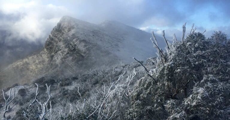
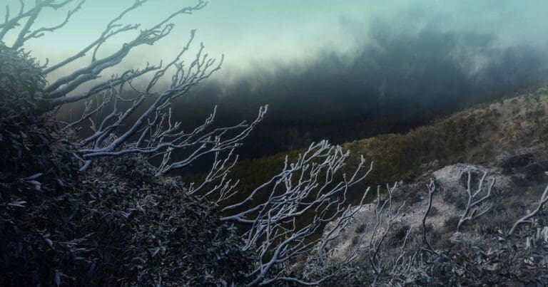
The Four and Six Mile Spurs hike is a remote circuit on the southern slopes of Mount Buller in Victoria. While the circuit can commence on Mount Buller this circuit commences at Gardiners Hut, also known as Four Mile Hut which is located on the Howqua River, Brocks Road, Tunnel Spur. From the hut, ford the Howqua river and follow the northern bank of the river west until you locate the start of four mile spur on your right. This trail is not often hiked so expect the trail to be difficult to find and overgrown. Continue to follow the spur in a north easterly direction, remaining on the high ground at all times. After 1.7km from your start point the spur will start to narrow and will gradually unfold into a typical rocky alpine trail. Once above the tree line, at around 1200m elevation, you should start to experience dramatic alpine views. All depending on the weather of course.
Continue to follow Four Mile Spur, following the occasional trail marker until you reach a vehicle management track. Follow this for a short distance among the Buller Lifts (Family Run) until you have the summit of Mount Buller in your sights. From here it is a short walk to the summit of Mount Buller at 1805m. If you are planning on staying in the village (and making this a two days hike) head back down the paved stairs and follow the wooden barrier until you reach the car park and the road back to the village. If you intend on camping follow the trail down the West Ridge and find a suitable camping spot close to the tree line.
The return section of this circuit commences close to where the ascent of Four Mile Spur ended. From the chair lifts locate the start of Little Buller Spur and commence your descent south along a well defined trail towards Little Buller. Immediately beyond Little Buller the ridge is not-so-well defined and splits off into a number of spurs that could easily lead you astray. Follow the more obvious spur south and commence your descent down the narrow, steep and rocky spur. Continue down the spur and along a series of rocky ridges, complete with rocky outcrops and amazing views. Take your time as this section can prove to be quite a challenge.
Six Mile Spur is not a straight forward descent as it twists and turns first south, the south east then west before taking you back to the trail head. Keep a keen eye on the terrain and ensure you remain on the high point of every ridge and spur as there are a number of side spurs that disappear to nowhere and can lead you astray.
Eventually the challenge and angle of the descent reduces and you will find the going a lot easier than before. The trail continues heading west and after a few kilometres you will see Four Mile Spur to the west and hear the sounds of the Howqua River below. The final section of the circuit is steep and requires a fair amount of bush bashing as you negotiate the regrowth along the final spur and river banks. Return to the trail head by fording the river (wherever you meet it) and locate a foot trail on the southern banks. Follow this west for a 1.5-2km, crossing the river multiple times until Gardiners Hut appears.
Camping
Until it reaches the Mount Buller Alpine Resort boundary, the lower portion of this circuit is within the Alpine National Park. Beyond this the land is managed by the Mount Buller and Mount Stirling Alpine Resort Management Board on behalf of the Crown. Camping is not permitted within the Mount Buller Alpine Resort, yet there are camping options on the West Ridge and Little Mount Buller outside the resort boundary. Select the most appropriate campsite to your direction of travel and time of initial departure. An alternative would be to start and end the circuit in the Alpine Resort an camp near Gardiners Hut on the Howqua River.
Water Procurement
There is no water available on either spur, except for a few creeks high on the mountain. Water is available in the Buller Alpine Village and from the Howqua River in the valley below.
Tips
A good portion of this circuit is off-trail and requires a high level of fitness, head for heights and rock scrambling skills. The circuit traverses two remote spurs in the Victorian Alps where weather can be unpredictable and rescue challenging. Six Mile Spur is one of Australia's craggiest major spurs and an ascent involves scrambling over steep, exposed rocks high on the mountain. If you are fit, the scrambling sections should not cause any major problems and are actually a lot of fun. On the lower section of Six Mile Spur there is no track. The spur is obvious and easy to follow, but some basic navigation knowledge is still required.
Expect Six Mile Spur to take approximately 7-8 hours. Four Mile Spur should take around 4-5 hours
Content use
Please don’t copy GPX files or content from this site to AllTrails or other platforms. Each trail has been personally mapped, documented, and refined to support Australia’s bushwalking and hiking community. While some details come from land managers, every listing reflects significant personal effort. This is a free, community-driven initiative—your respect helps keep it that way.
Walk map and GPX file
Max elevation: 1772 m
Min elevation: 486 m
Total climbing: 1676 m
Total descent: -1676 m
Getting there
Getting to the trailhead: Alpine National Park.
233km from Melbourne’s GPO via the Hume Highway and Mansfield. Gardiners Hut is accessed from the Gardiners Car park. NOTE: that this hut is locked unless you obtain the key first.
From Melbourne, follow the Hume Highway to the Tallarook turn-off and take the Upper Goulburn Road to the Goulburn Valley Highway, which leads you to Yea From Yea drive to Mansfield on the Maroondah Highway, then follow Mount Buller Road to approximately two kilometres past Merrijig before turning right on to the Howqua Track, (signposted Sheepyard Flat). Drive along the gravel road until reaching Sheepyard Flat, where the road’s name changes to Brocks Road. Pass Sheepyard Flat and the Tunnel Bend campsites, enter the Alpine National Park and arrive at the car park above Gardiners Hut.
Alternatively, take the Eastern Freeway and Maroondah Highway to Lilydale, then take the Melba Highway at Coldstream to Yea, follow the first description above after Yea
Closest towns to this walk: Benalla, Bright, Dinner Plain, Falls Creek, Harrietville, Hotham Heights, Mansfield, Mitta Mitta, Mount Beauty, Mount Hotham, Myrtleford, Omeo, Porepunkah, Tawonga South, Wangaratta
About the region
The Alpine National Park is a national park in the Central Highlands and Alpine regions of Victoria, Australia. The 646,000-hectare national park is located northeast of Melbourne. It is the largest National Park in Victoria, and covers much of the higher areas of the Great Dividing Range in Victoria, including Victoria's highest point, Mount Bogong at 1,986 metres and the associated subalpine woodland and grassland of the Bogong High Plains. The park's north-eastern boundary is along the border with New South Wales, where it abuts the Kosciuszko National Park.
Similar walks nearby
Looking for more walks in or near Alpine National Park? Try these trails with a similar difficulty grade.
Track grade
Grade 5 (Difficult) - Walks for the Most Experienced: Grade 5 represents the most challenging walking tracks on the AWTGS. These are only recommended for very experienced and fit walkers with specialised skills, including navigation and emergency first aid. Tracks are likely to be very rough, very steep, and unmarked. Walks may be more than 20 kilometers. These challenging walks demand a high level of fitness and experience to navigate difficult terrain, significant elevation changes, and potentially unformed paths.
Explore safe
Plan ahead and hike safely! Carry enough water, pack layers for changing conditions, and bring safety gear like a torch, PLB, and reliable communication device. Check official sources for trail updates, closures, and access requirements, and review local weather and bushfire advice. Most importantly, share your plans with someone before you go. Being prepared makes for a safer and more enjoyable hike! Stay Safe, Explore More, and Always #ExploreSafe.
Packing checklists
What you carry in your pack depends on factors like weather, terrain, and your adventure type. Not sure what to bring? My free planning, food, and packing checklists are a great starting point, covering day hikes, overnight trips, and multi-day adventures. Use them to customise your kit and always prioritise safety.
Let someone know
Before heading out, take a moment to fill out your trip intentions form. It’s a quick way to share your hike details with family or friends. If something goes wrong, they can notify emergency services, ensuring a faster response and peace of mind. Stay safe and enjoy your adventure
Suggest an edit
Spotted a change on this trail? Maybe there are new features, the route has shifted, or the trail is permanently closed. Whatever the update, I’d love your input. Your feedback helps fellow hikers stay informed and ensures that our trail info stays fresh and reliable.
Acknowledgement of Country
Trail Hiking Australia acknowledges the Traditional Owners of the lands on which we hike and pay respects to their Elders, past and present, and we acknowledge the First Nations people of other communities who may be here today.
/Four-&-Six-Mile-Spurs-Hike_85.jpg)
/Four-&-Six-Mile-Spurs-Hike_57.jpg)
/Four-&-Six-Mile-Spurs-Hike_41.jpg)
/Four-&-Six-Mile-Spurs-Hike_16.jpg)
/Four-&-Six-Mile-Spurs-Hike_30.jpg)
/Four-&-Six-Mile-Spurs-Hike_40.jpg)
/Four-&-Six-Mile-Spurs-Hike_102.jpg)
/Four-&-Six-Mile-Spurs-Hike_92.jpg)
/Four-&-Six-Mile-Spurs-Hike_63.jpg)
/Four-&-Six-Mile-Spurs-Hike_103.jpg)
/Four-&-Six-Mile-Spurs-Hike_17.jpg)
/Four-&-Six-Mile-Spurs-Hike_59.jpg)
/Four-&-Six-Mile-Spurs-Hike_7.jpg)
/Four-&-Six-Mile-Spurs-Hike_109.jpg)
/Four-&-Six-Mile-Spurs-Hike_49.jpg)


7 Reviews on “Four & Six Mile Spurs Hike (22km)”
The start and end of this hike require that you cross the Howqua River. Best to check water levels before you head up as the river may be impassable after heavy rain or snow melt.