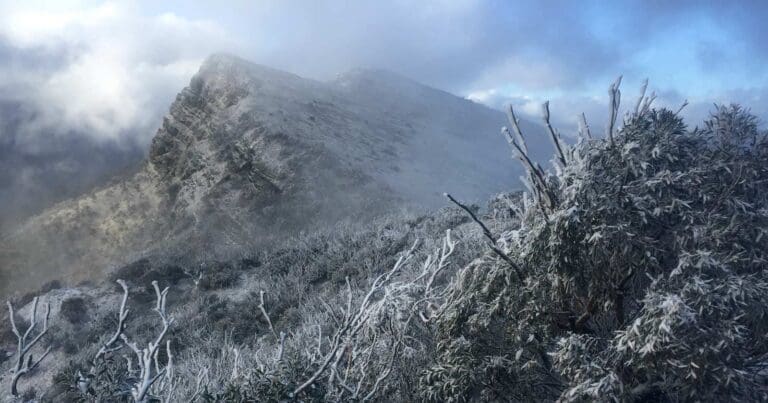
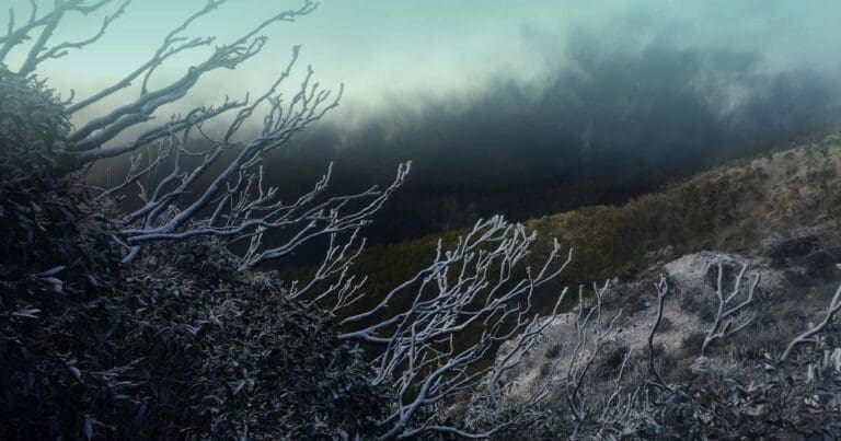
Eagle Peaks are in the heart of The Governors Remote & natural Area of the Alpine National Park, a remote area above the Howqua River. The Eagle Peaks Circuit is an extremely challenging hike that should only be undertaken by experienced hikers.
The circuit commences at Sheepyard Flat. Follow the gravel road from Sheepyard flat until you reach a walking trail that runs over to and alongside Lickhole Creek. Follow this trail until you reach the summit of Mount Darling.
From the summit, descend into Lickhole Gap and climb steeply onto the Eagle's Peaks. The entire spur from Mount Darling, through Lickhole Gap and up to Eagle Peaks is quite overgrown and requires a lot of bush bashing. The spur is steep and rocky in places and requires that you dont have a fear of heights or exposed ledges with the terrain being near-vertical in places to the 1,445 metre summit. Once on Ealge Peaks follow the narrow and rocky ridge line west, picking up the Eagle Peaks Track back to Dubons Flat. Turn left at the road junction and follow the road back to Sheepyard Flat.
Be prepared
This hike requires that you have a sufficient level of equipment (in good working order), fitness and self-reliance. A PLB is also highly recommended as this is a remote area. The last water source is in the creek crossing just before the ascent to Mount Darling. You will need to collect enough water to get you to your camp site and through the second day.
Please don’t copy GPX files or content from this site to AllTrails or other platforms. Each trail has been personally mapped, documented, and refined to support Australia’s bushwalking and hiking community. While some details come from land managers, every listing reflects significant personal effort. This is a free, community-driven initiative—your respect helps keep it that way.
Total distance: 26205 m
Max elevation: 1407 m
Min elevation: 444 m
Total climbing: 1752 m
Total descent: -1755 m
Getting there
Getting to the trailhead: Alpine National Park.
From Mansfield, continue along the Mount Buller Road for 19.5km to Merijig, then a further 2km to the Howqua Track turnoff on the right. Follow the unsealed Howqua Track for 16.5km to Sheepyard Flat.
Camping is available at Sheepyard Flat and if you wanted to make this a two day hike you can also camp on the saddle or summit of Mount Darling.
Closest towns to this walk: Benalla, Bright, Dinner Plain, Falls Creek, Harrietville, Hotham Heights, Mansfield, Mitta Mitta, Mount Beauty, Mount Hotham, Myrtleford, Omeo, Porepunkah, Tawonga South, Wangaratta
About the region
The Alpine National Park is a national park in the Central Highlands and Alpine regions of Victoria, Australia. The 646,000-hectare national park is located northeast of Melbourne. It is the largest National Park in Victoria, and covers much of the higher areas of the Great Dividing Range in Victoria, including Victoria's highest point, Mount Bogong at 1,986 metres and the associated subalpine woodland and grassland of the Bogong High Plains. The park's north-eastern boundary is along the border with New South Wales, where it abuts the Kosciuszko National Park.
Similar walks nearby
Looking for more walks in or near Alpine National Park? Try these trails with a similar difficulty grade.
Favourite

Favourite

Favourite

Favourite

Track grade
Grade 5 (Difficult) - Walks for the Most Experienced: Grade 5 represents the most challenging walking tracks on the
AWTGS. These are only recommended for very experienced and fit walkers with specialised skills, including navigation and emergency first aid. Tracks are likely to be very rough, very steep, and unmarked. Walks may be more than 20 kilometers. These challenging walks demand a high level of fitness and experience to navigate difficult terrain, significant elevation changes, and potentially unformed paths.
Explore safe
Plan ahead and hike safely! Carry enough water, pack layers for changing conditions, and bring safety gear like a torch, PLB, and reliable communication device. Check official sources for trail updates, closures, and access requirements, and review local weather and bushfire advice. Most importantly, share your plans with someone before you go. Being prepared makes for a safer and more enjoyable hike! Stay Safe, Explore More, and Always #ExploreSafe.
Packing checklists
What you carry in your pack depends on factors like weather, terrain, and your adventure type. Not sure what to bring? My free planning, food, and packing checklists are a great starting point, covering day hikes, overnight trips, and multi-day adventures. Use them to customise your kit and always prioritise safety.
Let someone know
Before heading out, take a moment to fill out your trip intentions form. It’s a quick way to share your hike details with family or friends. If something goes wrong, they can notify emergency services, ensuring a faster response and peace of mind. Stay safe and enjoy your adventure
Suggest an edit
Spotted a change on this trail? Maybe there are new features, the route has shifted, or the trail is permanently closed. Whatever the update, I’d love your input. Your feedback helps fellow hikers stay informed and ensures that our trail info stays fresh and reliable.
/Eagle-Peaks-Circuit-Hike_30.jpg)
/Eagle-Peaks-Circuit-Hike_13.jpg)
/Eagle-Peaks-Circuit-Hike_25.jpg)
/Eagle-Peaks-Circuit-Hike_27.jpg)
/Eagle-Peaks-Circuit-Hike_10.jpg)
/Eagle-Peaks-Circuit-Hike_9.jpg)
/Eagle-Peaks-Circuit-Hike_15.jpg)
/Eagle-Peaks-Circuit-Hike_5.jpg)
/Eagle-Peaks-Circuit-Hike_19.jpg)
/Eagle-Peaks-Circuit-Hike_20.jpg)
/Eagle-Peaks-Circuit-Hike_12.jpg)
/Eagle-Peaks-Circuit-Hike_24.jpg)
/Eagle-Peaks-Circuit-Hike_2.jpg)
/Eagle-Peaks-Circuit-Hike_1.jpg)
/Eagle-Peaks-Circuit-Hike_16.jpg)


4 Reviews on “Eagle Peaks Circuit Hike (26km)”
Received an update from a group who attempted this hike on 25/02/2023. We attempted this hike but couldn’t get through lickhole creek track to Mt darling due to huge blackberry infestation. Was super slow going have to cut/break down the blackberry. Turned back very cut up.
I’ve attempted this one twice, both times starting from Sheepyard Flat, but going clockise and anti-clockwise. To date I haven’t managed to complete the circuit. Going clockwise in May 2020 we ran out of daylight and water, camped near the final ascent up Eagle Peaks and then returned back the way we had come the next day. The second time in late 2021 going anti-clockwise the path 6-7km along the river was completely overgrown with blackberries – so I decided to turn around and try again another day. I will attempt this again, I hear the section near Eagle Peaks is great – but everything leading up to it is pretty miserable!
Looking forward to doing this hike
We attempted this circuit on 23 January 2016. The spur from Lickhole Gap to Eagle Peaks is overgrown, is quite steep and requires exposed rock scrambling in order to gain the summit. Members of our team were not confident so we were forced to turn back.
Claire!! ??
Can anyone say how reliable the water source on Mt Darling is? Looking to do this in November 🙂
Brad Atkinson is this THE eagles peak? Top of Brocks Rd near lickhole gap?