Daleys Point walking track is a 3.2km, grade 3 hike located in Bouddi National Park, New South Wales. The hike should take around 1.25 hours to complete.
Hike overview
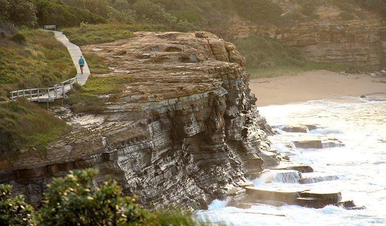
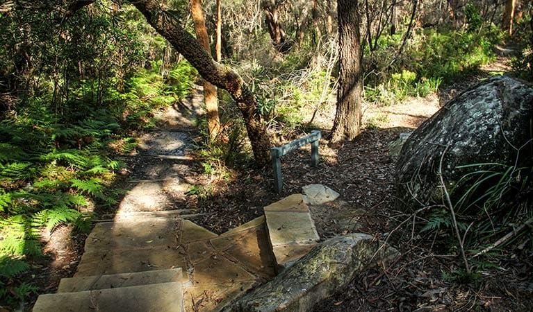
Daleys Point walking track, in Bouddi National Park, offers spectacular scenic views and an opportunity to experience unique Aboriginal cultural heritage. Starting near Wards Hill Road, this signposted track follows the ridgetop through beautiful bushlands with some short steep sections, to Daleys Point Aboriginal Site. It is a moderately easy walk that can be enjoyed on a family day trip.
Winding through the woodlands, listen for the distinctive call of glossy black cockatoos. In spring, the bush is dotted with native wildflowers including the delicate white flannel flower.
Before you know it you'll arrive at Daleys Point with spectacular scenic views over Cockle Bay Nature Reserve and Brisbane Water. Also known as Milligans Cave or Fish Hook Shelter, these sandstone engravings are an important Aboriginal site. While you admire and take in the significance of this special place, please remember to respect the surroundings so as not to damage engravings.
Route and GPX file
Help fellow hikers navigate with confidence. Share your GPX or KML file for this trail and help build a more comprehensive resource with precise waypoints and elevation profiles. Your contribution will empower adventurers with details they need for a safer and more enjoyable experience. I meticulously verify every file using official maps and surveys, ensuring the highest level of accuracy and reliability. Submit your file now and become a trailblazer for your fellow outdoor enthusiasts.
Trail location
Sorry, no records were found. Please adjust your search criteria and try again.
Sorry, unable to load the Maps API.
Getting there
To Allen Strom lookout carpark. Daleys Point walking track is in the Daleys Point precinct of Bouddi National Park. To get there:Take Central Coast Highway from Gosford and turn right onto Avoca DriveFollow Avoca Drive through Kincumber then turn right onto Empire Bay DriveContinue along Empire Bay Drive and turn left onto Wards Hill RoadDaleys Point walking track starts at the top of Wards Hill Road opposite Maitland Bay Drive Park entry points Allen Strom lookout carpark See on map Parking Parking is available at the top of Wards Hill Road near the track head.
Visit NSW National Parks and Wildlife Service for more information on this trail.
The longitude and latitude of the start and end points are approximately only and should not be used for navigation purposes. Please contact me if you know the correct coordinates.
Gallery
If you have any photos from this hike and are happy to share them, please upload your .jpg files here.
Please note: Uploading photos does not transfer ownership of copyright away from you. If requested, you will be credited for any photos you provide and can ask they be deleted at any time.
About the region
Bouddi National Park is located near Gosford on the New South Wales Central Coast. You'll find several great walks, as well as opportunities for camping, swimming and fishing. Bouddi National Park is always open but may have to close at times due to poor weather or fire danger.
Similar trails nearby
Explore Safe
While planning your hike, it’s important to check official government sources for updated information, temporary closures and trail access requirements. Before hitting the trail, check local weather and bushfire advice for planned burns and bushfire warnings and let someone know before you go. Plan ahead and hike safely.
Let someone know
Adventure with peace of mind: Fill out your trip intentions form. Before you hit the trail, fill out an online form to privately send important details about your hike to your family or friends. If you don’t return on time, they can easily alert emergency services, preventing worry and ensuring a swift response. Hike with peace of mind and enjoy your outdoor adventure to the fullest. Be smart, be safe: Register your plans here.
Gear to consider

My free planning, food and packing checklists provide an introduction to things your could consider (as well as the Ten Essentials) on your day, overnight and multi-day adventures. Customise your kit according to your personal needs, always considering safety first.
Suggest an edit
Does this hikes information need updating? Sometimes the route, trail features or access conditions change.
Acknowledgement of Country
Trail Hiking Australia acknowledges the Traditional Owners of the lands on which we hike and pay respects to their Elders, past and present, and we acknowledge the First Nations people of other communities who may be here today.


