Hike at a Glance
Max elevation: 656m
Min elevation: 445m
Total Ascent: 212m
Hike overview
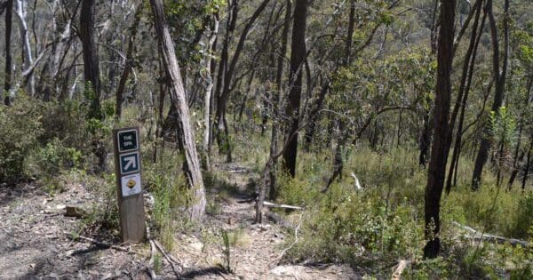
The Bluff Creek Nature Trail links the Bluff Creek visitor area with Bluff Falls and can be walked in either direction. For much of its route the track follows closely beside Bluff Creek through moist, ferny gullies and tall stands of Blue Gum trees. Interpretative panels along the way provide information on features of interest. Walking conditions are generally good although the section nearest the falls is steep in places. From Bluff Falls, either retrace your steps or return to the picnic area along the road and Wombat Track.
Camping
Basic visitor facilities are located at Bluff Creek, near the main entrance to the park, and also at Blue Gum Camp, Hinces Creek and Pine Mountain.
Tips
The park has limited permanent water sources - carry adequate drinking water when walking.
Walking conditions can be rough and rocky areas slippery when wet - wear sturdy footwear.
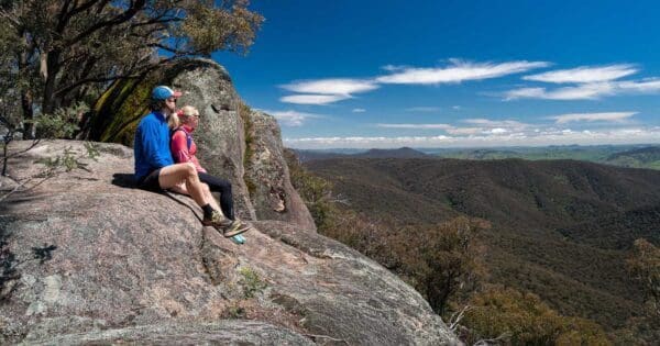
Cliffs and rocky bluffs occur within the park - be alert near the edge and look out for falling rocks.
Remote walking tracks may be poorly defined - carry an adequate map and compass or GPS.
Longer walking tracks require a good level of fitness and experience
Track grade
Grade 3 (Moderate) - Walks for Most Fitness Levels: Grade 3 on the AWTGS represents moderate walking tracks. These are ideal for walkers with some fitness who are comfortable with some hills and uneven terrain. While suitable for most ages, some bushwalking experience is recommended to ensure a safe and enjoyable experience. Tracks may have short, steep hill sections, a rough surface, and many steps. The total distance of a Grade 3 walk can be up to 20 kilometers.
Walk map and GPX file
Max elevation: 656 m
Min elevation: 445 m
Total climbing: 212 m
Total descent: -212 m
Content use
Please don’t copy GPX files or content from this site to AllTrails or other platforms. Each trail has been personally mapped, documented, and refined to support Australia’s bushwalking and hiking community. While some details come from land managers, every listing reflects significant personal effort. This is a free, community-driven initiative—your respect helps keep it that way.
Gallery
Got any photos from this hike? Your photos can help others plan. Share shots from along the trail so fellow hikers know what to expect.
Click to add your photos >>
Getting there
Getting to the trailhead: Burrowa-Pine Mountain National Park.
The park is located approximately 120 km east of Albury-Wodonga and 25 km northwest of Corryong. It lies between the Murray Valley Highway and the Murray River. Access to many popular visitor areas is from the all-weather Cudgewa Bluff Road, which passes through the park and is a pleasant scenic drive.
From Corryong, take Parish Lane from the western side of town (signposted to the National Park). Not far out of town, Parish Lane becomes the Briggs Gap Road, and provides a scenic start to the day, with the bitumen leading over the range from Corryong to the Cudgewa Creek Valley.
Follow Briggs Gap Road through to the C548 (the Cudgewa – Tintaldra Road, about 12km from town) and turn right, following the valley floor route through to the Cudgewa North Road, going off to the left. This is signposted to the National Park, and leads through cleared farmland to another signposted turn-off (also to the left) indicating that Cudgewa Bluff Falls are about six kilometres away.
If you are driving to the base of the Falls, then you need to continue along the access track (past the Bluff Creek area), following this winding track for about 2.5km, past the Blue Gums camping area (much smaller than the Bluff Creek area, with a creek to cross before gaining access) to the small car park about 200m from the Falls. Note that the camping area at Blue Gums, and the car park referred to here, are not suitable for caravans or large motorhomes (there is inadequate space to turn around).
Need a rental car to get you to the hike? Find one here.
Find a place to stay
Wondering where to stay near this hike? Find accommodation close to the trailhead — hotels, cabins and campgrounds nearby. Click the button to view the interactive map.
Closest towns to this walk: Beechworth, Cheshunt, Chiltern, Corryong, Eskdale, Kergunyah, Kiewa, Milawa, Mitta Mitta, Myrtleford, Osbornes Flat, Rutherglen, Tallangatta, Wangaratta, Wodonga, Wymah, Yackandandah
Let someone know
Heading out? Fill in a trip intentions form so someone knows your plans. If things go wrong, they can raise the alarm fast, giving you peace of mind on the trail.
About the region
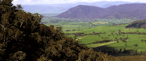
The Burrowa-Pine Mountain National Park is a national park in the Hume region of Victoria, Australia. The 18400ha national park is situated approximately northeast of Melbourne and east of Albury-Wodonga. The park stretches between Walwa Creek in the north-west and Cudgewa Creek in the southeast , both tributaries of the Murray River. There you will find Pine Mountain, one of the largest monoliths in the southern hemisphere, which is 1.5 times the size of Uluru. Another peak is Mount Burrowye.
Similar walks nearby
Looking for more walks in or near Burrowa-Pine Mountain National Park? Try these trails with a similar difficulty grade.
Explore safe
Plan ahead and hike safely! Carry enough water, pack layers for changing conditions, and bring safety gear like a torch, PLB, and reliable communication device. Check official sources for trail updates, closures, and access requirements, and review local weather and bushfire advice. Most importantly, share your plans with someone before you go. Being prepared makes for a safer and more enjoyable hike! Stay Safe, Explore More, and Always #ExploreSafe.
Packing checklists
What you carry in your pack depends on factors like weather, terrain, and your adventure type. Not sure what to bring? My free planning, food, and packing checklists are a great starting point, covering day hikes, overnight trips, and multi-day adventures. Use them to customise your kit and always prioritise safety.
Suggest an edit
Notice something different about this trail? Whether it’s a new feature, a route change, or a closure, share your update so we can keep our info accurate and helpful for fellow hikers.
Click to suggest edits >>
Acknowledgement of Country
Trail Hiking Australia acknowledges the Traditional Owners of the lands on which we hike and pay respects to their Elders, past and present, and we acknowledge the First Nations people of other communities who may be here today.


