Sorry, no records were found. Please adjust your search criteria and try again.
Sorry, unable to load the Maps API.
Explore stunning hiking trails of the Mount Buangor National Park
Discover the diverse trails of the Mount Buangor National Park, Victoria, offering hikes and walks for all skill levels and interests. Find your perfect adventure today.
Discover 9 hiking trails in Mount Buangor National Park



Granite Peaks, Fern Gullies and Forested Ranges at Mount Buangor
Overview
Mount Buangor National Park protects around 5,300 hectares of forested ranges between Ararat and Beaufort in Victoria’s Central West. The national park combines the former Mount Buangor State Park with approximately 2,800 hectares of the former Mount Cole State Forest, bringing together a larger section of the Mount Cole Range under one protected area. Mount Buangor rises to 989 metres and is the highest peak in this section of the Great Dividing Range.
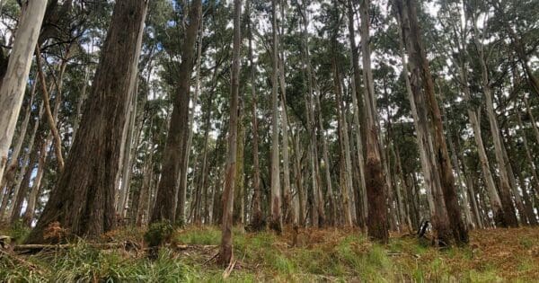
The landscape is remarkably varied over relatively short distances. Granite peaks and escarpments rise above tall eucalypt forest, while creeks descend through ferny gullies, waterfalls and sheltered flats. Higher elevations support Snow Gum communities, while Messmate Stringybark, Blue Gum and other forest types become prominent lower on the slopes. The addition of former Mount Cole State Forest broadens that landscape further, extending the national park across more of the surrounding ridges, gullies and headwater country.
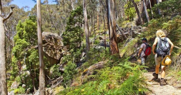
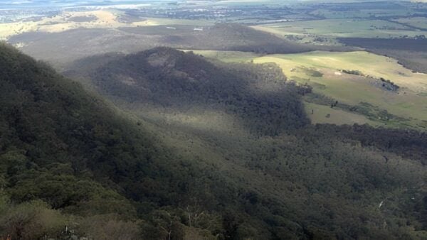
This variation in elevation, rainfall and aspect gives Mount Buangor a character that shifts constantly as you move through it. A walk can pass from dry open forest into a cool creek valley, climb through tall timber and emerge onto exposed granite with views across the plains surrounding the range.
Highlights
Mount Buangor itself is one of the defining features of the park. Rising to 989 metres, it sits on the southern edge of a large granitic plateau and offers extensive views across the surrounding countryside. Nearby Mount Sugarloaf and Cave Hill are also part of the same granite landscape, where long periods of erosion have exposed the resistant rock beneath much older sediments.
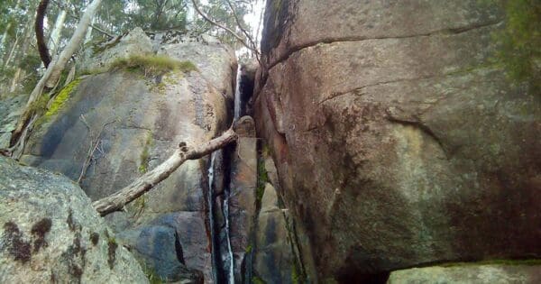
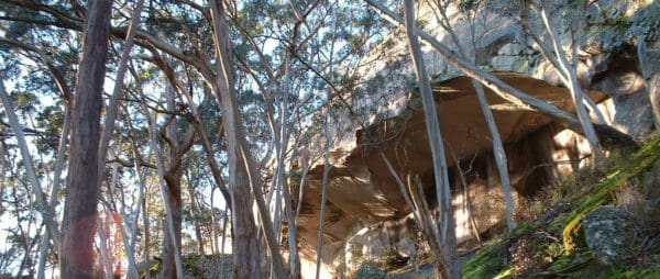
Granite appears throughout the park as exposed rock faces, steep slopes, boulders and overhangs. Around Cave Hill, the terrain becomes particularly rugged, while elsewhere the landscape is softened by tall forest and deeply shaded gullies. The contrast between these rocky heights and the lush lower slopes is one of the park’s most distinctive features.
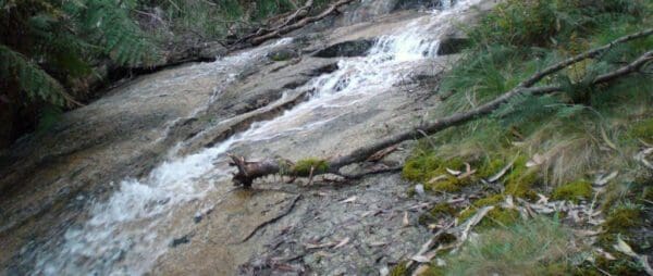
Water is another important part of the landscape. Middle Creek flows through fern gullies and past waterfalls in the former Mount Buangor State Park, while several other streams rise within the surrounding ranges. McLeod Creek forms part of the Buangor water catchment, while Spring Creek and Baranga Creek flow towards the Ararat Reservoir. The higher Mount Cole country also contributes to important headwater catchments extending beyond the park.
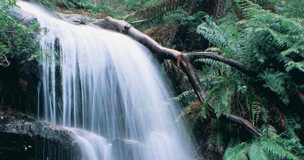
Ferntree Waterfalls is one of the best-known natural features in the lower part of the park, where water descends through a cool, heavily vegetated gully beneath tall eucalypts and ferns. Elsewhere, lookouts and higher tracks provide a completely different perspective, opening across the surrounding agricultural plains and ranges.
Walking in Mount Buangor National Park
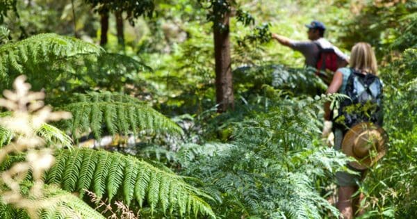
Mount Buangor has long been a popular bushwalking area, with routes ranging from short waterfall and forest walks to longer circuits climbing onto the higher ridges. The walking network developed across both the former state park and adjoining Mount Cole State Forest, so the creation of the national park brings many routes that previously crossed different land tenures into the same protected area. Parks Victoria has historically described around 15 kilometres of walking tracks within the former state park alone, with many continuing into the adjoining Mount Cole forests.
The terrain varies considerably. Lower walks follow creek flats and fern gullies, while routes towards Mount Buangor, Cave Hill and the surrounding ridges can involve sustained climbing, rougher surfaces and steep sections. Parts of the Bukkertillible and Sugarloaf walking routes have been identified by Parks Victoria as steep and semi-remote, particularly in wet conditions.
The wider Mount Cole and Mount Buangor landscape is also home to the Beeripmo Walk, one of the best-known overnight walks in western Victoria. The circuit travels through the forested ranges and provides a good introduction to the area’s changing vegetation, higher ridges and extensive views. Its route historically crossed between Mount Cole State Forest and Mount Buangor State Park, illustrating just how closely connected the two areas have always been as a walking landscape.
Best Time to Visit
Autumn through spring generally offers the most comfortable conditions for walking at Mount Buangor. The cooler months suit the steeper climbs and exposed higher ground, while rainfall brings life to the waterfalls, creeks and fern gullies.
Spring is particularly rewarding. Wildflowers appear through the open forests and higher slopes, and the differences between the park’s vegetation communities become more obvious as the forest responds to warmer conditions. The Mount Cole Range supports a number of plants with restricted distributions, making spring a good time to explore the park slowly rather than simply focusing on its summits and lookouts.
Winter can be cold and wet at higher elevations, but the forest often feels at its most atmospheric, particularly around Middle Creek and the sheltered gullies. Tracks may be slippery after rain and conditions on the exposed ridges can be considerably colder than on the surrounding plains.
Summer can bring hot, dry weather and elevated bushfire risk. Shaded forests and creek valleys may remain cooler than the surrounding open country, but walkers should check weather, fire danger, park conditions and closures before setting out.
Plants and Animals
Mount Buangor National Park protects a particularly diverse collection of vegetation communities. In the former Mount Buangor State Park, plant communities range from Snow Gum on the highest peaks to fern gullies along Middle Creek. Messmate Stringybark and Blue Gum forests form much of the broader forest character, with local changes in elevation, moisture and soil supporting a wide variety of other vegetation.
The botanical diversity of the area has long been recognised. The former Mount Buangor State Park alone had 324 recorded vascular plant species in surveys used for its management planning, including a large number considered significant because of their conservation status, restricted distribution or position at the edge of their known range. The larger national park now protects additional habitat formerly within Mount Cole State Forest.
One of the most notable plants is the Mount Cole Grevillea, a species with an extremely restricted natural distribution centred on the Mount Cole and Mount Buangor area. Victorian Government assessments identify only a small number of known populations, making protection of its remaining habitat particularly important.
Yarra Gum also occurs in the area, along with other plants associated with wetter flats and drainage lines. On drier slopes and ridges the vegetation becomes more open, while sheltered gullies support taller forest and dense fern growth. This close relationship between elevation, moisture and aspect helps explain why the park can look very different from one valley or ridge to the next.
Wildlife reflects the same diversity of habitat. Eastern Grey Kangaroos, wallabies, echidnas, koalas and possums occur through the forests, while mature trees and sheltered gullies provide habitat for species including Brush-tailed Phascogale and Powerful Owl. The wider Mount Cole and Mount Buangor forests also support a rich variety of woodland and forest birds.
Culture and Heritage
Mount Buangor National Park forms part of an Aboriginal cultural landscape with deep and continuing connections for Traditional Owners. Parks Victoria identifies the former Mount Buangor State Park as being on the traditional Country of the Eastern Maar Peoples, while the broader Mount Cole landscape is also strongly associated with Djab Wurrung Country and history. Historical records identify the Beeripmo Balug clan of the Djab Wurrung with the Mount Cole area.
These connections extend far beyond individual archaeological places or artefacts. Mountains, waterways, forests and other landscape features form part of a much larger cultural geography that long predates European settlement and continues to hold significance today.
European use of the ranges brought another layer of change. Timber harvesting became an important industry across Mount Cole, supported by sawmills, tracks and infrastructure established throughout the forest. Historic records identify former mill sites, a log chute and other forestry places within Mount Cole State Forest, while Mugwamp Hut is another surviving feature associated with the area’s more recent history.
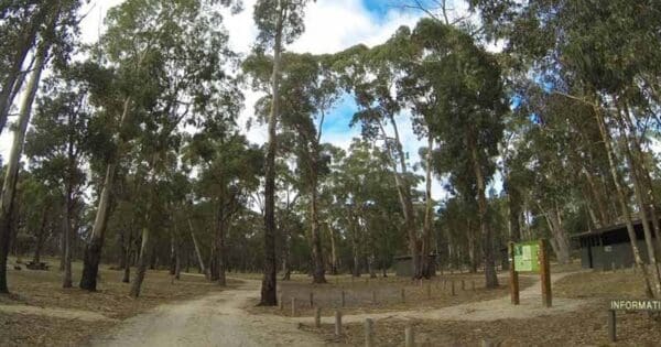
The forests also became important for water supply, recreation and conservation. Walking tracks, campgrounds and picnic areas developed across both Mount Buangor and Mount Cole, and generations of walkers came to experience them as one connected mountain landscape even while they were divided administratively between state park and state forest.
The creation of Mount Buangor National Park brought much of that landscape together. The former Mount Buangor State Park makes up about 47 per cent of the national park and approximately 2,800 hectares of former Mount Cole State Forest makes up the remaining 53 per cent. The result is a larger protected area encompassing granite peaks, waterfalls, creek valleys, mature forests and much of the country through which visitors have long walked between Mount Buangor and Mount Cole.
A Mountain Landscape of Contrasts
Mount Buangor National Park is defined by contrast. Exposed granite peaks rise above sheltered fern gullies. Dry ridges give way to tall, damp forest. Waterfalls and creek flats sit beneath slopes that open onto wide views across the plains of western Victoria.
Its expansion into the former Mount Cole State Forest also makes more sense of the landscape as a whole. The forests, ridges and walking routes did not stop at the old state park boundary, and many of the area’s best-known walks have always crossed between Mount Buangor and Mount Cole. The national park now protects a much larger part of that connected mountain system, from the lower forest and waterfalls to the high ridges of the Mount Cole Range.
Find more places to explore…
Help expand the trail collection!
Know of an official trail not listed on Trail Hiking Australia? I’m focused on showcasing the best tracks managed by land managers, and I’d love your help! Sharing a trail adds to our community and helps others discover safe, new adventures.
Submit your trail here

