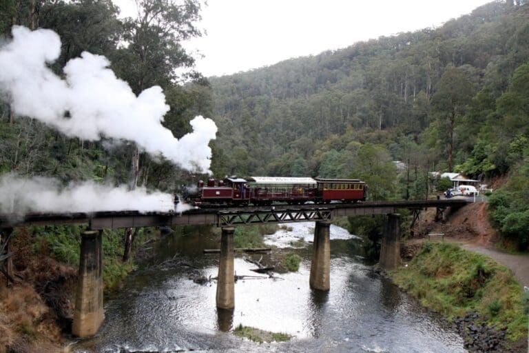
Walhalla to Thomson Station via Poverty Point is a 12.5km, grade 3 hike located in Walhalla Historic Area, Victoria. The hike should take around 4 hours to complete.
Hike overview
The Walhalla to Thomson Station hike commences in the heart of historic Walhalla. Follow the trail leading up the steps opposite the general store (or the steps adjacent to the band rotunda) up to the old tramway above the town. From the tramway there is a good view of the Walhalla township strung out along the narrow valley of Stringers Creek.
The hike follows the first 8 kilometres of the Australian Alps Walking Track (AAWT) along the level bed of the tramway which winds its way past mine heads and through regenerated forest and ferny gullies. After 4 km the tramway crosses Mormon Town Track on the crest of a spur and turns north wards up the Thompson River Valley winding in and out of small gullies for some 4km until it reaches the Poverty Point Bridge (aka Old Steel Bridge).
After crossing the bridge the hike departs from the AAWT and back tracks along the opposite bank of the Thomson River along a level track for 4km to the bottom end of Old Depot Road. From here it is a short walk which passes under the Walhalla Road to the Thomson Station.
Returning to the trail head
If you time your hike well enough, the train will return you to the Walhalla Railway Station. The Walhalla Goldfields Railway is operated and maintained by volunteers and is one of the most spectacular rail journeys in Australia winding through the spectacular Stringers Creek Gorge.
From the station there is a 500 metre walk back to the trail head.
Alternatively you can follow the AAWT for approximately 4km and retrace your steps back to Walhalla.
Route and GPX file
Max elevation: 396 m
Min elevation: 226 m
Total climbing: 573 m
Total descent: -694 m
Trail location
Sorry, no records were found. Please adjust your search criteria and try again.
Sorry, unable to load the Maps API.
Getting there
Walhalla is 184km east of Melbourne. Access is via Princes Freeway (M1) to Moe, north through Erica (C466), turn east to Rawson then left to Walhalla (C461).
About the region
Walhalla, a rich gold producer for 50 years, is a remote and picturesque mountain township. It is hard to imagine a more difficult site for a town than the steep, narrow valley of Stringers Creek as it winds down through the dense forests of the Baws Baws. Yet in its heyday, between 1880 and 1895, more than 4000 people lived there.
The town is the start of the 650 km Australian Alps Walking Track to the ACT. But most people come to discover the remnants of a community that defied a forbidding environment in its quest for gold. The best way to see the town is on foot.
Similar trails nearby
Explore Safe
While planning your hike, it’s important to check official government sources for updated information, temporary closures and trail access requirements. Before hitting the trail, check local weather and bushfire advice for planned burns and bushfire warnings and let someone know before you go. Plan ahead and hike safely.
Let someone know
Adventure with peace of mind: Fill out your trip intentions form. Before you hit the trail, fill out an online form to privately send important details about your hike to your family or friends. If you don’t return on time, they can easily alert emergency services, preventing worry and ensuring a swift response. Hike with peace of mind and enjoy your outdoor adventure to the fullest. Be smart, be safe: Register your plans here.
Gear to consider

My free planning, food and packing checklists provide an introduction to things your could consider (as well as the Ten Essentials) on your day, overnight and multi-day adventures. Customise your kit according to your personal needs, always considering safety first.
Suggest an edit
Does this hikes information need updating? Sometimes the route, trail features or access conditions change.
Acknowledgement of Country
Trail Hiking Australia acknowledges the Traditional Owners of the lands on which we hike and pay respects to their Elders, past and present, and we acknowledge the First Nations people of other communities who may be here today.


