Sidings Rail Trail is a 26km, grade 2 hike located in Regional Western Australia, Western Australia. The hike should take around 7 hours to complete.
Hike overview
The Sidings Rail Trail runs between the old railway bridge in the Nannup Foreshore Park and Jarrahwood
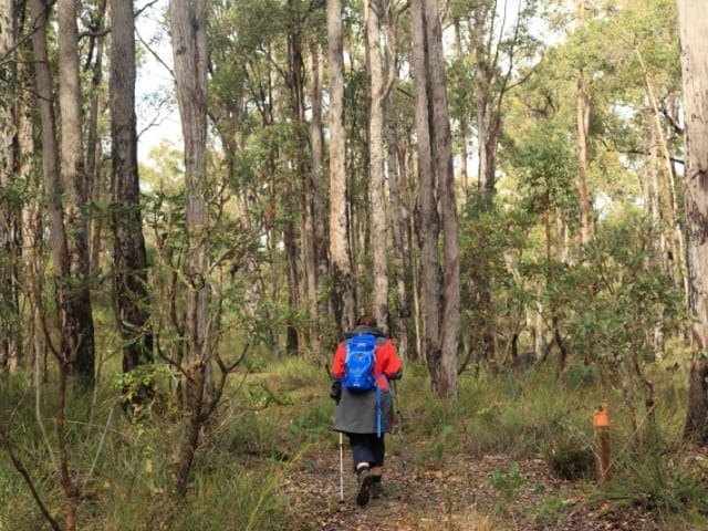
The southern end of the Sidings Rail Trail is at the old railway bridge in the Nannup Foreshore Park and runs as far as Jarrahwood. The trail is mainly gravel surface and is still loose in some sections. At various places sleepers have been left in place adjacent to the path on very short sections to give an impression of how it looked before conversion to a trail. There are several small railway bridges along the way some of which have been used as crossings and some where the trail runs alongside on a new smaller bridge. Another rail trail, the Old Timberline Trail takes a parallel route as far as Cambray Siding providing the option of a 37 km loop.
Leaving Nannup, the Old Timberline Trail branches to the left after the railway bridge while the Sidings Rail Trail continues north and crosses the Vasse Highway. After a second crossing of the highway it passes through the sites of three railway sidings, the biggest being Cambray where you can still see original sleepers and track in the ground. The Old Timberline Trail links up here. Keep an eye out for the sign. There are still a number of rail spikes, fishplates, sleepers and pieces of track spread around the sides of the trail. There are even some original distance signs on posts at the side of the trail. These are white with black numbers. The trail forms part of the Munda Biddi Trail.
Main distances: Section Distance from Nannup
Bibilup Siding 7.5 km
Dellerton Siding 12 km
Cambray Siding 15 km
Cambray Siding via Old Timberline Trail 22km
St John Brook Bridge 20 km
Jarrahwood 26 km
Thanks to Carl Bentley for assistance with this description.
Route and GPX file
Help fellow hikers navigate with confidence. Share your GPX or KML file for this trail and help build a more comprehensive resource with precise waypoints and elevation profiles. Your contribution will empower adventurers with details they need for a safer and more enjoyable experience. I meticulously verify every file using official maps and surveys, ensuring the highest level of accuracy and reliability. Submit your file now and become a trailblazer for your fellow outdoor enthusiasts.
Tips
Nannup to Jarrahwood in Regional Western Australia
300km south of Perth
Compacted earth, Coarse gravel, Fine gravel
Flat and undulating
Photo credit: Rail Trails Australia. For more information and a location map please visit RailTrails Australia.
Trail location
Sorry, no records were found. Please adjust your search criteria and try again.
Sorry, unable to load the Maps API.
Gallery
If you have any photos from this hike and are happy to share them, please upload your .jpg files here.
Please note: Uploading photos does not transfer ownership of copyright away from you. If requested, you will be credited for any photos you provide and can ask they be deleted at any time.
About the region
A Wander out Yonder in WA will make you feel like you've truly reset, reconnected and had a real holiday. WA is full of adventures waiting to be discovered. Travel further, stay for longer and explore the wonders only WA can offer. Share the water with wild dolphins, or see the gorges of Kalbarri from a new perspective in WA there's more in store than you could ever see.
Similar trails nearby
Explore Safe
While planning your hike, it’s important to check official government sources for updated information, temporary closures and trail access requirements. Before hitting the trail, check local weather and bushfire advice for planned burns and bushfire warnings and let someone know before you go. Plan ahead and hike safely.
Let someone know
Adventure with peace of mind: Fill out your trip intentions form. Before you hit the trail, fill out an online form to privately send important details about your hike to your family or friends. If you don’t return on time, they can easily alert emergency services, preventing worry and ensuring a swift response. Hike with peace of mind and enjoy your outdoor adventure to the fullest. Be smart, be safe: Register your plans here.
Gear to consider

My free planning, food and packing checklists provide an introduction to things your could consider (as well as the Ten Essentials) on your day, overnight and multi-day adventures. Customise your kit according to your personal needs, always considering safety first.
Suggest an edit
Does this hikes information need updating? Sometimes the route, trail features or access conditions change.
Acknowledgement of Country
Trail Hiking Australia acknowledges the Traditional Owners of the lands on which we hike and pay respects to their Elders, past and present, and we acknowledge the First Nations people of other communities who may be here today.


