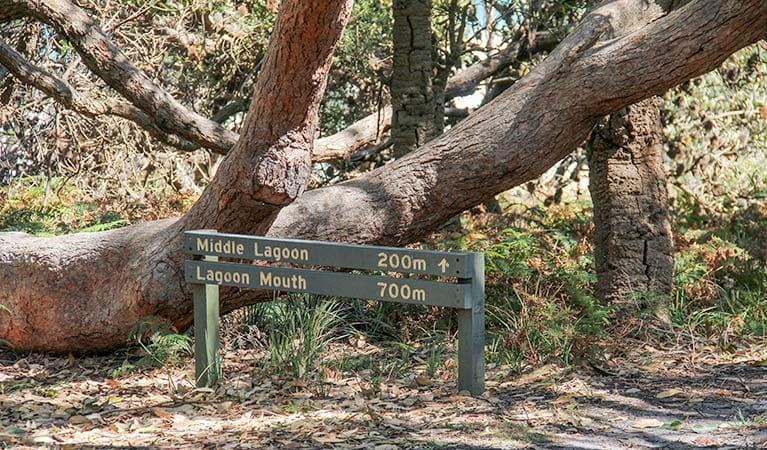
Mimosa Rocks walking track is a 1km, grade 2 hike located in Mimosa Rocks National Park, New South Wales. The hike should take around 45 minutes to complete.
Hike overview
The Mimosa Rocks walking track is in the northern section of the park, it's an easy walk so a great one for children, plus it is wheelchair accessible.
Start your walk at Aragunnu carpark - there's a well-defined track linking the section's two picnic areas. Follow this short track then continue north another 250m on a paved path and boardwalk.
The boardwalk crosses over the largest Aboriginal midden in the park - take your time to read about the history and significance of the area along the way.
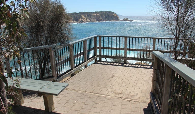
At the boardwalk's end, you'll be rewarded with dramatic views over the rocks from the lookout. Keep an eye out for the large pyramid-shaped rock - beneath it rests the shipwrecked Mimosa, a paddle steamer that ran aground in 1863, and after which the park is named.
Route and GPX file
Help fellow hikers navigate with confidence. Share your GPX or KML file for this trail and help build a more comprehensive resource with precise waypoints and elevation profiles. Your contribution will empower adventurers with details they need for a safer and more enjoyable experience. I meticulously verify every file using official maps and surveys, ensuring the highest level of accuracy and reliability. Submit your file now and become a trailblazer for your fellow outdoor enthusiasts.
Trail location
Sorry, no records were found. Please adjust your search criteria and try again.
Sorry, unable to load the Maps API.
Getting there
The Mimosa Rocks walking track is in the Aragunnu precinct of Mimosa Rocks National Park. To get there, follow the Tathra-Bermagui Road, then turn onto Aragunnu Road and follow it to the picnic area. Road quality Access road, picnic areas and campgrounds at this site are not suitable for large vehicles including caravans, motorhomes and buses. Check the weather before you set out as the road to Mimosa Rocks walking track can become boggy when it rains. Parking Parking is available at Arragunnu a few metres from the northern and southern picnic areas
Visit NSW National Parks and Wildlife Service for more information on this trail.
The longitude and latitude of the start and end points are approximately only and should not be used for navigation purposes. Please contact me if you know the correct coordinates.
Gallery
If you have any photos from this hike and are happy to share them, please upload your .jpg files here.
Please note: Uploading photos does not transfer ownership of copyright away from you. If requested, you will be credited for any photos you provide and can ask they be deleted at any time.
About the region
Located not far from Bega on the far south coast of NSW, Mimosa Rocks National Park offers a great camping holiday. Visit today to go fishing or birdwatching.
Just a short drive from Bega, Mimosa Rocks National Park offers up show-stopping headland views, beaches and pure lagoons, and you'll be spoilt for choice with lookouts, rainforest pockets and historic sites to explore.
The park takes its name from the Paddle Steamer Mimosa that wrecked in 1863 after running onto rocks at the northern end of the park. The rocks of Mimosa have distinctive castle-like features that are the result of intricate folds, faults and intrusions occurring in the rock. For a view you'll never forget, head to Bunga Head for sunrise, the rocks look magnificent backed by the pinks of the early morning sky.
Similar trails nearby
Explore Safe
While planning your hike, it’s important to check official government sources for updated information, temporary closures and trail access requirements. Before hitting the trail, check local weather and bushfire advice for planned burns and bushfire warnings and let someone know before you go. Plan ahead and hike safely.
Let someone know
Adventure with peace of mind: Fill out your trip intentions form. Before you hit the trail, fill out an online form to privately send important details about your hike to your family or friends. If you don’t return on time, they can easily alert emergency services, preventing worry and ensuring a swift response. Hike with peace of mind and enjoy your outdoor adventure to the fullest. Be smart, be safe: Register your plans here.
Gear to consider

My free planning, food and packing checklists provide an introduction to things your could consider (as well as the Ten Essentials) on your day, overnight and multi-day adventures. Customise your kit according to your personal needs, always considering safety first.
Suggest an edit
Does this hikes information need updating? Sometimes the route, trail features or access conditions change.
Acknowledgement of Country
Trail Hiking Australia acknowledges the Traditional Owners of the lands on which we hike and pay respects to their Elders, past and present, and we acknowledge the First Nations people of other communities who may be here today.


