The Buller Huts Trail is a 96km, grade 5 circuit hike located in the Alpine National Park, Victoria. The hike should take around 7-10 days to complete.
Warning
A TREK FOR EXPERIENCED HIKERS: The Buller Huts Trail is not an easy stroll through open woodland. It is a serious grade 5 undertaking for well–prepared, self-reliant adventurers, with a good level of fitness and who understand the risks of walking in a remote alpine area. Weather can change rapidly, even in summer, when people have been caught under-prepared in cold, wet and windy weather.
Hike overview
For those seeking an immersive alpine adventure, the Buller Huts Trail is a must-do. This challenging 96-kilometer circuit traverses some of Victoria's most spectacular mountain peaks, valleys, and high country huts.
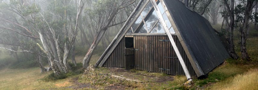
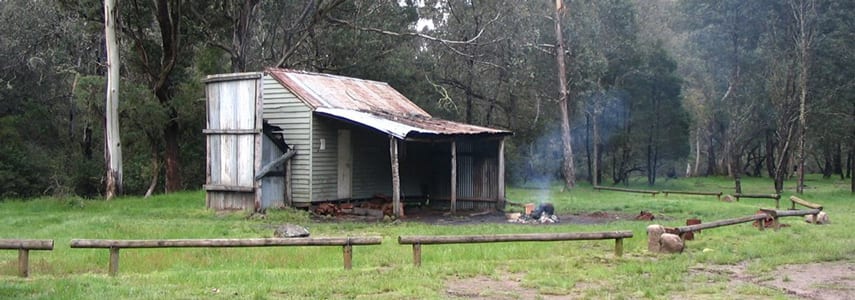
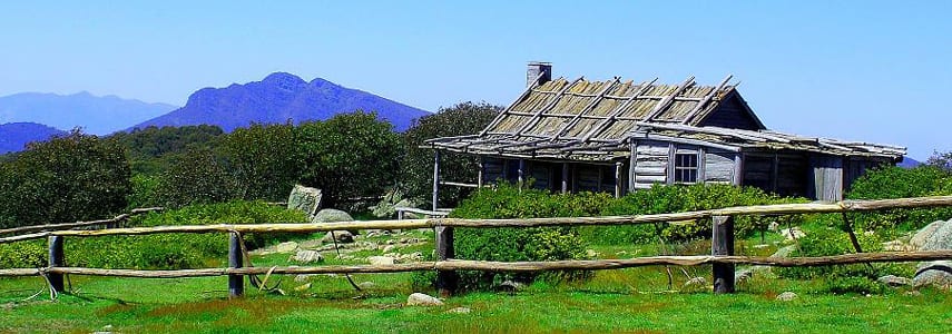
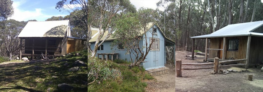
Starting at Mount Buller, the trail winds its way through snow gums, wildflowers, and granite tors, offering breathtaking vistas of the surrounding ranges. Along the way, you'll pass through iconic landmarks such as Bluff Hut, Lovicks Hut, and Craig's Hut, each with its own unique history and charm.
The Buller Huts Trail is not for the faint of heart. With steep ascents and descents, as well as unpredictable weather conditions, it's important to be well-prepared and experienced in alpine hiking. However, the rewards are immense. The sense of accomplishment you'll feel upon completing the circuit is unparalleled, and the memories you make will last a lifetime.
The Buller Huts Trail is your opportunity to independently experience the best of the Victorian Alps. Offering breathtaking scenery and a true sense of remoteness, the Buller Huts Trail commences on Mount Buller, high in the Victorian Alps and traverses some of Victoria’s most spectacular mountain summits and historic high country huts.
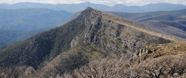
Over seven days this 96km, grade 5, journey will allow you to independently experience a variety of natural landscapes including deep fern-lined gullies, steep and unrelenting spurs, rugged ridge lines, exhilarating mountain summits and spectacular cliff-top outlooks.
The Buller Huts Trail is a circuit trek that commences on Mount Buller, high in the Victorian Alps, and can be undertaken in either direction. It is recommended though that you follow the suggested itinerary as this will allow you to tackle the most challenging ascents early in the hike when you have more energy to expend.
Suggested itinerary
Day 1: Mount Buller to Eight Mile Flat (17.3km)
The Buller Huts Trail commences on Mount Buller, high in the Victorian Alps, at an altitude of just over 1660m and traverses some of Victoria's most spectacular mountain summits. These include Mount Buller, The Bluff, Mount Eadley Stoney, Mount Lovick, Mount Magdala, Mount Howitt, Mount Buggery, Mount Speculation, Mount Koonika, The Monument and Mount Stirling.
Commencing on Athletes Walk, near the junction of Mount Buller and Summit Roads. Follow the walks until you reach the junction of Summit Road. Turn left and walk along Summit Road to the carpark. The Summit Nature Trail starts here. Follow the trail initially north west as it twists and turns to the summit of Mount Buller (1805m). Some walkers may prefer to commence the hike at the summit car park. Your preferred start point in the Mount Buller Alpine Resort is completely up to you really, where you start, you will end.
From the summit, retrace your steps to the first junction. Turn left at this point to continue along the Summit Nature Trail. Turning south west at the junction follow the Family ski run to the start of Four Mile Spur. The trail now descends along this often narrow spur for approximately 6.5km to the Hoqwua River below.
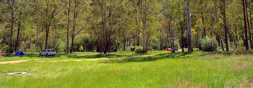
Turning east, follow the Howqua River a further 6.5km as it winds its way through the valley to Eight Mile Flat. An excellent camp site on the banks of the Howqua River.
Day 2: Eight Mile Flat to Bluff Hut (12.5km)
From a pleasant grassy clearing beside the Howqua River, The trail now climbs steadily through dry open forest along Eight Mile Spur. The final stages of the ascent to the rugged natural ramparts of the Bluff are quite steep, but the rewards are soon evident. From the treeless 1,725 metre summit a spectacular alpine panorama unfolds, stretching to Mount Buller in the north and faraway Lake Eildon.
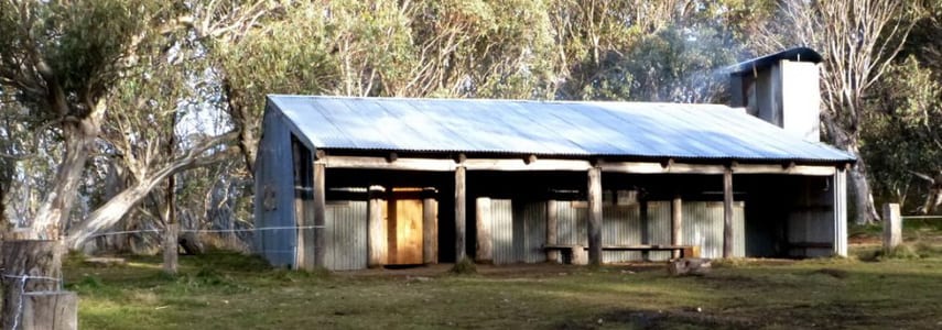
The trail continues through alpine meadows, carpeted with brilliant wildflowers in early summer, to Bluff Hut and a sheltered campsite among the nearby snow gums.
Day 3: Bluff Hut to Hells Window (13.5km)
Follow Bluff Track east from Bluff hut over the summit of Mount Lovick (1684m) for approximately 5.6km to the junction of Cairn Creek Track. Turn north at this point and descend to Lovicks Hut.
Approximately 1.2km north of the hut the junction of Helicopter Spur will be reached. This is one of the steepest spurs in this region and quite a rewarding hike in its own right. Turn east at this point and continue along Bluff Track, past Picture Point (with spectacular views) then on to the junction of the Australian Alpine Walking Trail. Follow the trail in a north easterly direction towards Mount Magdala traversing one of the best sections of the long-distance Australian Alps Walking Track.
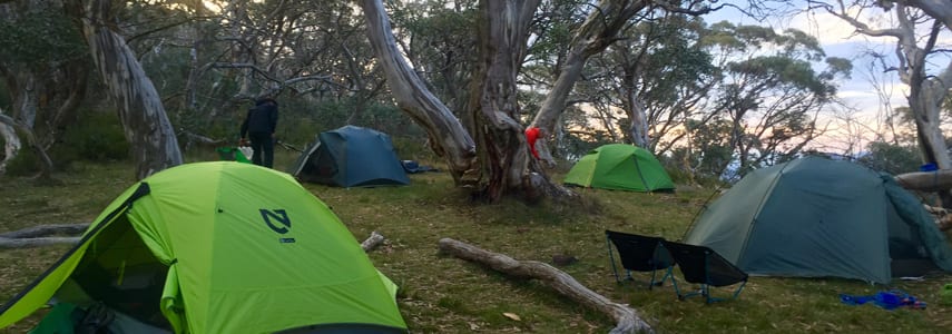
Descend past Hells Window to the saddle between Magdala and Big Hill where you will find an open grassy campsite amongst the snow gums.
Day 4: Hells Window to Speculation Road (13.6km)
From the campsite continue along the trail, which heads north east, towards Mount Howitt. Take the time here to soak up the views across the Cross Cut Saw to the north before descending Mount Howitt to the junction of the Cross Cut Saw and Mount Howitt Walking Track. From this point head directly east to Macalister Springs and the Vallejo Gantner Hut.
Macalister Springs is a very reliable water source and worth a visit if you were unable to locate water the night before. Return via the same route to the junction of the Cross Cut Saw. The Crosscut Saw is a scramble along a narrow ridge and is not for those with a fear of heights. This traverse will lead you over the summit of Mount Buggery, through horrible Gap and to the broad summit of Mount Speculation. Continue over the summit, heading north east and descend to Speculation Road and a reliable water source and campsite at Camp Creek.
Day 5: Speculation Road to King Hut (12.3km)
Heading north north west continue along Speculation Road for approximately 7.2km and locate Muesli Spur to the west. The trail along the spur is reasonably well worn and should be easy to follow as it descends steeply towards the King River in the Valley below.
At the end of Muesli Spur you will again intersect Speculation Road. Turn left (almost straight ahead) at this point and follow Speculation Road then King Basin Road for approximately 1.4km until you reach King Hut and an open grassy campsite.
Day 6: King Hut to Craigs Hut (13.5km)
Follow King Basin Road north west for approximately 6.4km and locate McCormacks Trail on the south side of the road. Follow the trail along a broad spur for 3.2km to the junction of Circuit Road. Turning left, follow the rod a short distance (200m) to continue your ascent along McCormacks Trail.
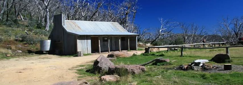
After approximately 1.7km you will again reach Circuit Road.Turn right at this point and follow the road for 1km where you will locate the Craigs Hut Walk on your left. Follow this trail to the top of the knoll and Craigs Hut. Here you will find grassy flats for camping, fire pits and toilet facilities.
Day 7: Craigs Hut to Mount Buller (13.3km)
From Craigs hut, locate the Clear Hills Track and follow it in a south westerly direction towards the summit of Mount Stirling (1749m). There are a number of huts in the area of Mount Stirling providing emergency refuge to visitors. Bluff Spur Hut, west of the summit, was erected as a memorial to a pair of skiers who died of exposure on the mountain. Geelong Grammar School Hut, north east of the summit, is owned by Geelong Grammar School and is used during cross country skiing by students from the Timbertop campus.
Follow the Howqua Gap trail south from Mount Stirling and descend 2.1km along the ridge to a trail junction at Howqua Gap. Turn west and follow Corn Hill Track along Wooly Butt Spur past Howqua Gap Hut to Corn Hill Road. After a short distance, turn right onto the Wombat trail and follow this west to the junction of Stirling and Corn Hill Roads.
Continue along Stirling Road until you locate the first Village Circuit trail on your left. Alternatively you could follow the Split Rock trail which runs parallel to Stirling Road. Once on the Village Circuit trail, follow this along its length until you reach The Avenue. Turn right then a quick left before the car park and follow the trail back to Athletes Walk and the end of the circuit.
If you're looking for an unforgettable alpine adventure, the Buller Huts Trail is the perfect choice. With its stunning scenery, historic huts, and challenging terrain, it's sure to leave you with a lasting impression.
Finding Water
Day 1: Mount Buller to Eight Mile Flat (17.3km approx).
Water is available from the Howqua River at Eight Mile Flat.
Day 2: Eight Mile Flat to Bluff Hut (12.5km approx).
Water is available from a rainwater tank attached to the hut but do not rely on this as the hut is accessible by 4WD and can often be dry.
Day 3: Bluff Hut to Hells Window (13.5km approx).
Water is often available south of the campsite in the gully which is Hell Fire Creek. Descend along a faint trail, turning right on reaching the creek to access the most reliable source in the area. It is important to note that this creek is often not flowing during summer and should not be relied upon.
Day 4: Hells Window to Speculation Road (13.6km approx)
Water can be located at the head of the gully at Camp Creek which passes under Speculation Road.
Day 5: Speculation Road to King Hut (12.3km approx)
Water is available from the King River.
Day 6: King Hut to Craigs Hut (13.5km approx)
Water is available from a rainwater tank near Craigs Hut but do not rely on this as the hut is accessible by 4WD and can often be dry.
Day 7: Craigs Hut to Mount Buller (13.3km approx)
Water is available from the Mount Buller Resort."
Video Teaser
Visit the official website at www.bullerhutstrail.com.au
Download the Article by Laura Waters, Featured in Outdoor Magazine
Route and GPX file
Max elevation: 1772 m
Min elevation: 488 m
Total climbing: 5474 m
Total descent: -5474 m
The following is an alternate itinerary (129km approx)
Courtesy of Mark Hipgrave
Day 1 (15.7km). Drove from Melb to Buller, left the car at the summit and walked down Four Mile Spur to the Howqua River at Gardiners Hut, then east to Six Mile Flat
Day 2 (20.1km). Six Mile Flat to Eight Mile Flat, then up Eight Mile Spur to Refrigerator Gap then up to the Bluff and the Bluff Track to Bluff Hut.
Day 3 (21.5km). Bluff Hut to Lovicks Hut, Picture Point, Mount Magdala, Mount Howitt and then Valejo Gantner Hut
Day 4 (25.7km). From VJ Hut, across the Crosscut Saw to Mount Buggery, Mount Speculation, then down to Spec Road and a long walk across Mustering Flat to Lake Cobbler Hut
Day 5 (16km). Lake Cobbler to Mount Cobbler, then back south to the top of Muesli Spur, and west down the spur to King River Hut
Day 6 (17km). King River Hut, west along the old King River Rd to Peters Corner, Craig's Hut and then GGS Hut at Mount Stirling
Day 7 (13km). A short walk from the GGS Hut back to Mount Buller via Howqua Gap
Max elevation: 1735 m
Min elevation: 486 m
Total climbing: 7165 m
Total descent: -7166 m
Trail features
- Rough Trail
- Undefined Trail
- Alpine Region
- Alpine Huts
- Exposed Ledges
- Rock Scrambling
- Steep Terrain
- Off Trail
- River Crossings
- Scenic Viewpoints
- Untreated Water
- Overnight Campsites
Tips
- Be well-prepared for all types of weather conditions. The weather in the alpine region can change quickly, so it's important to be prepared for anything.
- Carry a map and compass, or GPS device, and know how to use them. The trail is well-marked, but it's always a good idea to have a backup plan in case you get lost.
- Let someone know your plans and expected return date. This is especially important if you're hiking solo.
- Be aware of the risks of hiking in the alpine region. These risks include hypothermia, dehydration, and altitude sickness.
- Take your time and enjoy the journey. The Buller Huts Trail is a challenging but rewarding experience.
Trail location
Sorry, no records were found. Please adjust your search criteria and try again.
Sorry, unable to load the Maps API.
Getting there
From Melbourne, take the Hume Fwy/National Highway M31, C382, Goulburn Valley Hwy/B340, B300 and Mount Buller Rd/C320 to Summit Rd in Mount Buller. Continue on Summit Road Drive to the Buller Village. The trail head is opposite Georges along Athletes Walk. View in google Maps
This is a challenging hike that should not be underestimated. Do not attempt this hike during Summer or Winter.
This hike requires that you have a sufficient level of equipment (in good working order), fitness and self-reliance. It is vital that you take personal responsibility for ensuring you are prepared!
About the region
The Alpine National Park is a national park located in the Central Highlands and Alpine regions of Victoria, Australia. The 646,000-hectare national park is located northeast of Melbourne. It is the largest National Park in Victoria, and covers much of the higher areas of the Great Dividing Range in Victoria, including Victoria's highest point, Mount Bogong at 1,986 metres and the associated subalpine woodland and grassland of the Bogong High Plains. The park's north-eastern boundary is along the border with New South Wales, where it abuts the Kosciuszko National Park.
Similar trails nearby
Explore Safe
While planning your hike, it’s important to check official government sources for updated information, temporary closures and trail access requirements. Before hitting the trail, check local weather and bushfire advice for planned burns and bushfire warnings and let someone know before you go. Plan ahead and hike safely.
Let someone know
Adventure with peace of mind: Fill out your trip intentions form. Before you hit the trail, fill out an online form to privately send important details about your hike to your family or friends. If you don’t return on time, they can easily alert emergency services, preventing worry and ensuring a swift response. Hike with peace of mind and enjoy your outdoor adventure to the fullest. Be smart, be safe: Register your plans here.
Gear to consider

My free planning, food and packing checklists provide an introduction to things your could consider (as well as the Ten Essentials) on your day, overnight and multi-day adventures. Customise your kit according to your personal needs, always considering safety first.
Suggest an edit
Does this hikes information need updating? Sometimes the route, trail features or access conditions change.
Acknowledgement of Country
Trail Hiking Australia acknowledges the Traditional Owners of the lands on which we hike and pay respects to their Elders, past and present, and we acknowledge the First Nations people of other communities who may be here today.




2 Reviews on “The Buller Huts Trail (96km)”
What an absolutely fantastic hike. Well worth every gruelling moment.
Hi Darren, this hike looks fantastic, I’m planning to do it over the Easter break in April together with my husband. I’m definitely an avid bushwalker and have done tracks like the South Coast Track that seems to compare in terms of the level 5 grading. Could I just ask whether it is a fairly visible track/markers/cairns or is compass navigation required?
Thanks! Marlena
Going to give this a go over Easter. Got the winter gear in tow as we have no idea what to expect 7 days in advance.
Looks great to a novice alpine walker… one thing is possible lack of water. Suggestions? Early spring better? any and all hints gratefully accepted.
Stuart
Around November is the best time of year. It’s best to wait until after the winter snow melt as the river at the foot of four mile spur can be quite swollen and impossible to cross.
Thanks for the inspiration. Just finished this circuit on 19/11/17, did Buller to 8 mi, 8 mi to bluff hut, bluff hut to Mac springs, mac springs to king hut, king hut to woolly but spur and then rtn’d to Buller, great overview of this area, good reccy walk for future wanderings too. Luke
Hi, has anyone hiked the Buller Huts Trail in the last few weeks? I’m looking to do it between Christmas and New Year and wonder what water availability is like?
By far, this has to be the best alpine hike in Victoria. Well worth the preparation and effort. Man, what a challenge