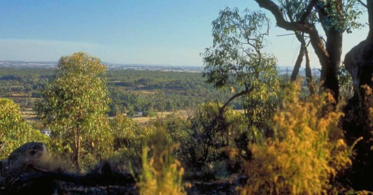
Gulpa Creek walk is a 5km, grade 3 hike located in Murray Valley National Park, New South Wales. The hike should take around 2 hours to complete.
Hike overview
From the historic little town of Mathoura, at Crane's Bridge, where bullock teams once hauled logs to the timber mill, you can set out on Gulpa Creek walk.
It's a flat, easy 5km walk or ride among the river red gums along Gulpa Creek in Murray Valley Regional Park, adjacent to Murray Valley National Park. The colours and movement of birdlife around the creek and the light on the red gums are quite a view, and make this walk quite special. Gulpa Creek is also a peaceful spot for canoeing or kayaking. What's more, because of Gulpa Creek walk's location in Murray Valley Regional Park, you can even bring your dog along for the ride.
You might also like to bring along your binoculars and a bird book so you can identify the birds you see along the way. If you feel like more birdwatching, visit Reed Beds Bird Hide boardwalk in the nearby Murray Valley National Park.
Route and GPX file
Help fellow hikers navigate with confidence. Share your GPX or KML file for this trail and help build a more comprehensive resource with precise waypoints and elevation profiles. Your contribution will empower adventurers with details they need for a safer and more enjoyable experience. I meticulously verify every file using official maps and surveys, ensuring the highest level of accuracy and reliability. Submit your file now and become a trailblazer for your fellow outdoor enthusiasts.
Tips
Gulpa Creek is a great destination for canoeing - bring your own equipment or contact Mathoura Visitor Information Centre on (03) 5884 3730 for details of small boat or canoe hire
Remember to take your binoculars if you want to go bird watching
Visit NSW National Parks and Wildlife Service for more information on this trail.
The longitude and latitude of the start and end points are approximately only and should not be used for navigation purposes. Please contact me if you know the correct coordinates.
Trail location
Sorry, no records were found. Please adjust your search criteria and try again.
Sorry, unable to load the Maps API.
Getting there
To Crane's Bridge. Gulpa Creek walk is in the Gulpa Island precinct of Murray Valley National Park. To get there:From Mathoura, head to Crane's Bridge at the northern end of town.Cross Crane's Bridge and turn right to follow the walking track along Gulpa CreekAfter 1.1km, you can turn onto Liston Bridge to return to Mathoura or walk on along the track creek for another 2.5km.At the end of the track, you can cross a wooden bridge to stroll along Poley's loop for a further 1.5km. If you're leaving the track at Poley's loop, turn west along Picnic Point Road and right onto Cobb Highway to return to Mathoura. Park entry points Crane's Bridge See on map Poley's Bridge See on map Parking Parking is available at Crane's Bridge, at the start of Gulpa Creek walk, or at Poley's bridge if you feel like walking from the other end.
Gallery
If you have any photos from this hike and are happy to share them, please upload your .jpg files here.
Please note: Uploading photos does not transfer ownership of copyright away from you. If requested, you will be credited for any photos you provide and can ask they be deleted at any time.
About the region
Explore majestic river red gums or Ramsar-listed wetlands in Murray Valley National Park on a camping to the Riverina. Go birdwatching, fishing, bike riding and kayaking. Part of the largest continuous red gum forest in the world, this region hosts a unique ecosystem with over 60 threatened native animal species and 40 threatened plant species. It is also an important place for Aboriginal people.
Similar trails nearby
Explore Safe
While planning your hike, it’s important to check official government sources for updated information, temporary closures and trail access requirements. Before hitting the trail, check local weather and bushfire advice for planned burns and bushfire warnings and let someone know before you go. Plan ahead and hike safely.
Let someone know
Adventure with peace of mind: Fill out your trip intentions form. Before you hit the trail, fill out an online form to privately send important details about your hike to your family or friends. If you don’t return on time, they can easily alert emergency services, preventing worry and ensuring a swift response. Hike with peace of mind and enjoy your outdoor adventure to the fullest. Be smart, be safe: Register your plans here.
Gear to consider

My free planning, food and packing checklists provide an introduction to things your could consider (as well as the Ten Essentials) on your day, overnight and multi-day adventures. Customise your kit according to your personal needs, always considering safety first.
Suggest an edit
Does this hikes information need updating? Sometimes the route, trail features or access conditions change.
Acknowledgement of Country
Trail Hiking Australia acknowledges the Traditional Owners of the lands on which we hike and pay respects to their Elders, past and present, and we acknowledge the First Nations people of other communities who may be here today.


