Glenorchy Mountain Bike Park is a 10km, grade 3 hike located in Glenorchy, Tasmania. The hike should take around 2.5 hours to complete.
Hike overview
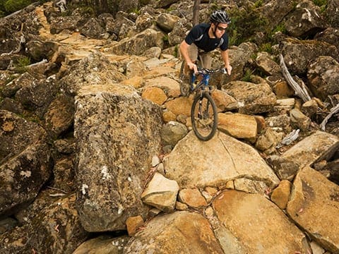
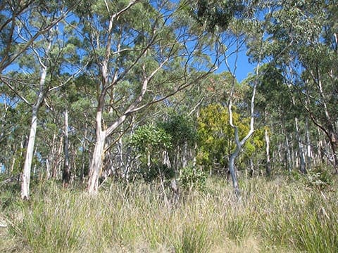
The Glenorchy Mountain Bike Park includes Cross Country, Downhill, Mountain Cross, Dirt Jumps and Northshore tracks. Various trails feed into the park through steep dry Eucalypt forest and open up into the main jump area. Riders can also start or finish the North South multi-use track from the Mountain Bike Park.The park provides mountain bike riding opportunities for all skill levels, including 'extreme' riders. Bushwalking and on-lead dog walking is also welcome. For more information please contact the Glenorchy City Council.
For detailed information on trails in the surrounding area it is recommended that visitors purchase the Wellington Park Recreation Map - this map, along with the general Tasmanian 1:25,000 series, is available from maps shops, Service Tasmania, and the Tasmania Visitor Information Centre.
Safety
Many of the tracks contain 'extreme' drops, jumps and obstacles. Riders should always inspect the track before riding and ride within their limits. When using the park you are required to:
Route and GPX file
Max elevation: 0 m
Min elevation: 0 m
Total climbing: 0 m
Total descent: 0 m
For more information on this trail, visit Greater Hobart Trails
Tips
Many of the tracks contain 'extreme' drops, jumps and obstacles. Riders should always inspect the track before riding and ride within their limits. When using the park you are required to:
Trail location
Sorry, no records were found. Please adjust your search criteria and try again.
Sorry, unable to load the Maps API.
Getting there
The park is located at the top end of Tolosa Street, just past Tolosa Park. The gate remains locked for security reasons, however you may push your bike through the space provided on either side of the gate. The park is only a few hundred metres past the gate.
Gallery
If you have any photos from this hike and are happy to share them, please upload your .jpg files here.
Please note: Uploading photos does not transfer ownership of copyright away from you. If requested, you will be credited for any photos you provide and can ask they be deleted at any time.
About the region
The City of Glenorchy is Tasmania's fourth largest city. Glenorchy is located in the Greater Hobart metropolitan area in Southern Tasmania. It is about 7 km north of Tasmania's capital city, Hobart, and is nestled below the Wellington Range on the western shore of the River Derwent.
Explore Safe
While planning your hike, it’s important to check official government sources for updated information, temporary closures and trail access requirements. Before hitting the trail, check local weather and bushfire advice for planned burns and bushfire warnings and let someone know before you go. Plan ahead and hike safely.
Let someone know
Adventure with peace of mind: Fill out your trip intentions form. Before you hit the trail, fill out an online form to privately send important details about your hike to your family or friends. If you don’t return on time, they can easily alert emergency services, preventing worry and ensuring a swift response. Hike with peace of mind and enjoy your outdoor adventure to the fullest. Be smart, be safe: Register your plans here.
Gear to consider

My free planning, food and packing checklists provide an introduction to things your could consider (as well as the Ten Essentials) on your day, overnight and multi-day adventures. Customise your kit according to your personal needs, always considering safety first.
Suggest an edit
Does this hikes information need updating? Sometimes the route, trail features or access conditions change.
Acknowledgement of Country
Trail Hiking Australia acknowledges the Traditional Owners of the lands on which we hike and pay respects to their Elders, past and present, and we acknowledge the First Nations people of other communities who may be here today.


