Fire Tower Walk is a 400m, grade 2 hike located in Dryandra Woodland, Western Australia. The hike should take around 20 minutes to complete.
Hike overview
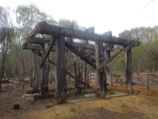
This short walk meanders around East Contine Hill, a laterite breakaway that was the ideal site for the lookout towers used during the summer fire season. These towers were staffed during the summer fire season by forestry workers and their wives who were known as "spotters".
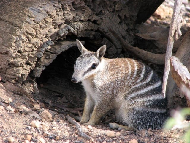
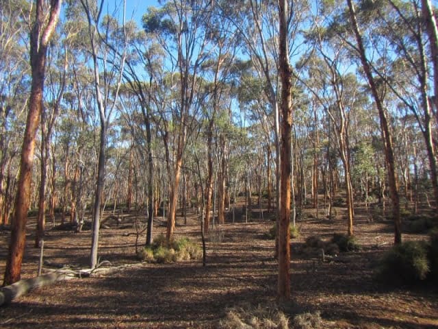
Dryandra Woodland features the largest area of remnant vegetation in the western Wheatbelt and forms part of an international biodiversity 'hotspot' where more than 850 species of plants can be seen. The woodland of wandoo, kwongan (the Aboriginal woRoad for heath and shrublands), mallee, sheoak thickets and plantations of brown mallet is home to the numbat, Western Australia's state fauna emblem. It is also home to other threatened and remarkable fauna such as the red-tailed phascogale, woylie, western grey kangaroo, tammar wallaby, brushtail possum and echidna as well as a diverse variety of reptiles and insects. The remains of two historical fire lookout towers can be found along the trail.
Route and GPX file
Help fellow hikers navigate with confidence. Share your GPX or KML file for this trail and help build a more comprehensive resource with precise waypoints and elevation profiles. Your contribution will empower adventurers with details they need for a safer and more enjoyable experience. I meticulously verify every file using official maps and surveys, ensuring the highest level of accuracy and reliability. Submit your file now and become a trailblazer for your fellow outdoor enthusiasts.
Tips
Start Point: Contine Hill Picnic Area, Rosedale Road, near Dryandra, 200km (2.5hours) south east of Perth
End Point: Contine Hill Picnic Area, Rosedale Road, near Dryandra, 200km (2.5hours) south east of Perth
Region: Dryandra Woodland, Golden Outback
For more information, a location map and GPS file please visit Trails WA.
Trail location
Sorry, no records were found. Please adjust your search criteria and try again.
Sorry, unable to load the Maps API.
Getting there
Dryandra Woodland is less than two hours drive from Perth on sealed roads. Roads within the Woodland are unsealed, but accessible by all vehicles.
Gallery
If you have any photos from this hike and are happy to share them, please upload your .jpg files here.
Please note: Uploading photos does not transfer ownership of copyright away from you. If requested, you will be credited for any photos you provide and can ask they be deleted at any time.
About the region
Dryandra Woodland, near Narrogin, is a valuable nature conservation area featuring the largest remnant of original vegetation in the western Wheatbelt. 24 mammal, 98 bird and 41 reptile species are all known to call Dryandra home, including Western Australia's state mammal emblem, the numbat (Myrmecobius fasciatus).
Similar trails nearby
Explore Safe
While planning your hike, it’s important to check official government sources for updated information, temporary closures and trail access requirements. Before hitting the trail, check local weather and bushfire advice for planned burns and bushfire warnings and let someone know before you go. Plan ahead and hike safely.
Let someone know
Adventure with peace of mind: Fill out your trip intentions form. Before you hit the trail, fill out an online form to privately send important details about your hike to your family or friends. If you don’t return on time, they can easily alert emergency services, preventing worry and ensuring a swift response. Hike with peace of mind and enjoy your outdoor adventure to the fullest. Be smart, be safe: Register your plans here.
Gear to consider

My free planning, food and packing checklists provide an introduction to things your could consider (as well as the Ten Essentials) on your day, overnight and multi-day adventures. Customise your kit according to your personal needs, always considering safety first.
Suggest an edit
Does this hikes information need updating? Sometimes the route, trail features or access conditions change.
Acknowledgement of Country
Trail Hiking Australia acknowledges the Traditional Owners of the lands on which we hike and pay respects to their Elders, past and present, and we acknowledge the First Nations people of other communities who may be here today.


