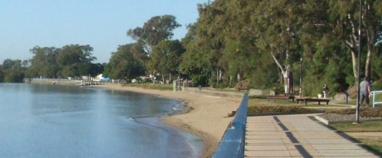
Ferny Grove Rail Trail is a 5km, grade 2 hike located in South East Queensland, Queensland. The hike should take around 1.75 hours to complete.
Hike overview
The surburban railway to Ferny Grove once extended a further 32km to Dayboro. Short sections of this railway are now rail trails. Although short, they are popular with Brisbane mountain bikers due to their proximity to the many trails in the Brisbane Forest Park and the Samford Valley. The trails are now signposted.
Some short but picturesque sections of rail trail close to Brisbane. Accessible from Ferny Grove Railway Station. Roads occupy the old rail corridor within the Brisbane City Council Area. The former railway is clearly evident in the Conservation Park, rejoining quiet local roads for the section into Samford.
An extensive network of recreation trails has been mapped by the Moreton Bay Regional Council, more suitable for horse riders and mountain bikes than walkers. Trails within the and around Samford are easy to locate.
Stage one from Ferny Grove to Peterson Road is now fully sealed, whith up graded lighting at the major road crossings
The Lanita rail trail can be easily accessed from Ferny Grove Station. Leaving Ferny Grove railway station, the first 2.5km (approx) of the old railway alignment is now road. Lanita Road is a quiet outer suburban street, suitable for walking or cycling.
Lanita Road, Ferny Grove Ferny Grove Railway Station to Currawong Road, Samford
Route and GPX file
Help fellow hikers navigate with confidence. Share your GPX or KML file for this trail and help build a more comprehensive resource with precise waypoints and elevation profiles. Your contribution will empower adventurers with details they need for a safer and more enjoyable experience. I meticulously verify every file using official maps and surveys, ensuring the highest level of accuracy and reliability. Submit your file now and become a trailblazer for your fellow outdoor enthusiasts.
Tips
Ferny Grove to Samford in South East Queensland
Samford Valley, north west of Brisbane, 16km from Brisbane
Sealed
For more information and a location map please visit RailTrails Australia.
Trail location
Sorry, no records were found. Please adjust your search criteria and try again.
Sorry, unable to load the Maps API.
Gallery
If you have any photos from this hike and are happy to share them, please upload your .jpg files here.
Please note: Uploading photos does not transfer ownership of copyright away from you. If requested, you will be credited for any photos you provide and can ask they be deleted at any time.
Similar trails nearby
Explore Safe
While planning your hike, it’s important to check official government sources for updated information, temporary closures and trail access requirements. Before hitting the trail, check local weather and bushfire advice for planned burns and bushfire warnings and let someone know before you go. Plan ahead and hike safely.
Let someone know
Adventure with peace of mind: Fill out your trip intentions form. Before you hit the trail, fill out an online form to privately send important details about your hike to your family or friends. If you don’t return on time, they can easily alert emergency services, preventing worry and ensuring a swift response. Hike with peace of mind and enjoy your outdoor adventure to the fullest. Be smart, be safe: Register your plans here.
Gear to consider

My free planning, food and packing checklists provide an introduction to things your could consider (as well as the Ten Essentials) on your day, overnight and multi-day adventures. Customise your kit according to your personal needs, always considering safety first.
Suggest an edit
Does this hikes information need updating? Sometimes the route, trail features or access conditions change.
Acknowledgement of Country
Trail Hiking Australia acknowledges the Traditional Owners of the lands on which we hike and pay respects to their Elders, past and present, and we acknowledge the First Nations people of other communities who may be here today.


