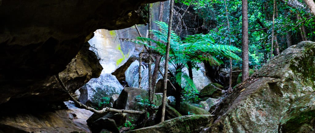
Dripping Rock and the Overhang is a 3.2km, grade 3 hike located in Cania Gorge National Park, Queensland. The hike should take around 1.25 hours to complete.
Hike overview
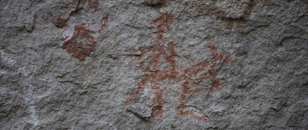
This pleasant walk starts at the southern end of the picnic area. After crossing the Three Moon Creek the track winds through eucalypt woodland and dry rainforest before leading to the base of Dripping Rock (2.2km return). The track is mostly flat with steps on the uphills , a section of boardwalk is found near a rock shelter where Indigenous art can be seen just short of the start of Dripping Rock.
The track continues approximately 500 meters to The Overhang, where weathering and erosion has eroded the base of the sandstone cliff with striking yellow and red features. Tree ferns and small puddles of water are found in this area.

Route and GPX file
Max elevation: 354 m
Min elevation: 290 m
Total climbing: 101 m
Total descent: -101 m
Trail location
Sorry, no records were found. Please adjust your search criteria and try again.
Sorry, unable to load the Maps API.
Getting there
From Monto, head north on the Burnett Highway and after 11.5km turn right into Cania Road (signposted Cania Gorge). Follow this for 13.7km and park by the picnic area and information board on the right, about 1km beyond the Cania Gorge Tourist Retreat.
Contributed by Daves Hayes
Gallery
If you have any photos from this hike and are happy to share them, please upload your .jpg files here.
Please note: Uploading photos does not transfer ownership of copyright away from you. If requested, you will be credited for any photos you provide and can ask they be deleted at any time.
About the region
Cania Gorge is a national park in the North Burnett Region, Queensland, Australia. The park is 373 km northwest of Brisbane. The nearest town is Monto. Three Moon Creek is the name of the waterway that runs along the length of the gorge.
The park's most dominant features are the 70 m sandstone cliffs.[2] Wildlife native to the park include rock wallabys, bettong, platypus, geckos and over 90 bird species.
Aboriginal rock art on the cliff walls is an indication of indigenous settlement of at least 19,000 years.
A picnic area is located alongside the main road into the park, 8 km from the Burnett Highway. Facilities here include covered picnic tables, toilets and gas-powered barbecues. The majority of the park's walking tracks lead from this picnic area, including the 1.1 km trail to Dripping Rock, 1.6 km trail to The Overhang, and the 1.3 km trail to Bloodwood Cave. The longest track in the park leads from a small car park 500 metres south of the picnic area. This 5.6 km circuit takes in Giants Chair Lookout, with views across the gorge; and Fern Tree Pool, a permanent waterhole. Only walkers with moderate levels of fitness should attempt this track. Another walk leads visitors to a former mine site.

Similar trails nearby
Explore Safe
While planning your hike, it’s important to check official government sources for updated information, temporary closures and trail access requirements. Before hitting the trail, check local weather and bushfire advice for planned burns and bushfire warnings and let someone know before you go. Plan ahead and hike safely.
Let someone know
Adventure with peace of mind: Fill out your trip intentions form. Before you hit the trail, fill out an online form to privately send important details about your hike to your family or friends. If you don’t return on time, they can easily alert emergency services, preventing worry and ensuring a swift response. Hike with peace of mind and enjoy your outdoor adventure to the fullest. Be smart, be safe: Register your plans here.
Gear to consider

My free planning, food and packing checklists provide an introduction to things your could consider (as well as the Ten Essentials) on your day, overnight and multi-day adventures. Customise your kit according to your personal needs, always considering safety first.
Suggest an edit
Does this hikes information need updating? Sometimes the route, trail features or access conditions change.
Acknowledgement of Country
Trail Hiking Australia acknowledges the Traditional Owners of the lands on which we hike and pay respects to their Elders, past and present, and we acknowledge the First Nations people of other communities who may be here today.


