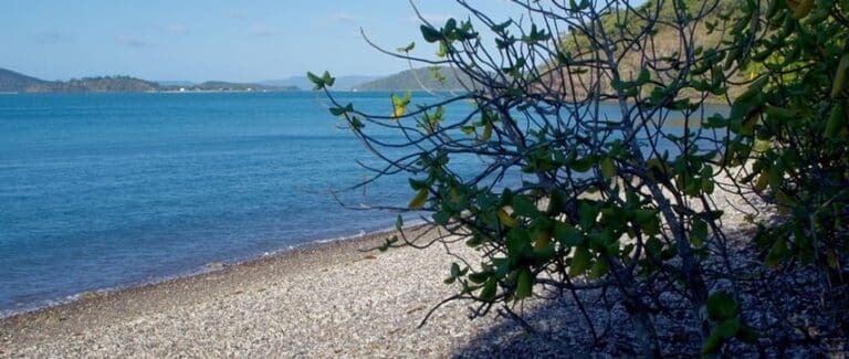
Diversity Boardwalk is a 1.2km, grade 2 hike located in Cape Hillsborough National Park, Queensland. The hike should take around 45 minutes to complete.
Hike overview
Meander through Melaleuca woodland, a mangrove community, open eucalypt forest and vine thicket. The diversity of the unique flora that forms to create the natural paradise of Cape Hillsborough National Park is represented along the popular Diversity Boardwalk. This trail illustrates the way the Yuibera Aboriginal people used the park's native plants for survival.
Route and GPX file
Help fellow hikers navigate with confidence. Share your GPX or KML file for this trail and help build a more comprehensive resource with precise waypoints and elevation profiles. Your contribution will empower adventurers with details they need for a safer and more enjoyable experience. I meticulously verify every file using official maps and surveys, ensuring the highest level of accuracy and reliability. Submit your file now and become a trailblazer for your fellow outdoor enthusiasts.
Trail location
Sorry, no records were found. Please adjust your search criteria and try again.
Sorry, unable to load the Maps API.
Gallery
If you have any photos from this hike and are happy to share them, please upload your .jpg files here.
Please note: Uploading photos does not transfer ownership of copyright away from you. If requested, you will be credited for any photos you provide and can ask they be deleted at any time.
About the region
Cape Hillsborough is a national park in Mackay Region, Queensland, Australia.
The park is 837 km northwest of Brisbane. The park is a peninsula of volcanic origin, covered largely by rainforest; the maximum elevation is 267 m. The cape at the tip of the peninsula was named by Lieutenant James Cook during his first voyage to the Pacific in 1770; the name is in honour of Wills Hill, Earl of Hillsborough who was President of the Board of Trade and Plantations from 1765 to 1765. The nearest major town is Mackay, about 40 km to the southeast.
The park is located within the O'Connell River water catchment area and the Central Mackay Coast bioregion.
On National Parks Day 2010 (Sunday, 28 March 2010) the Queensland State Government announced the addition of 204 hectares to the park.
For more information on this hiking trail, please visit Queensland.com
Similar trails nearby
Explore Safe
While planning your hike, it’s important to check official government sources for updated information, temporary closures and trail access requirements. Before hitting the trail, check local weather and bushfire advice for planned burns and bushfire warnings and let someone know before you go. Plan ahead and hike safely.
Let someone know
Adventure with peace of mind: Fill out your trip intentions form. Before you hit the trail, fill out an online form to privately send important details about your hike to your family or friends. If you don’t return on time, they can easily alert emergency services, preventing worry and ensuring a swift response. Hike with peace of mind and enjoy your outdoor adventure to the fullest. Be smart, be safe: Register your plans here.
Gear to consider

My free planning, food and packing checklists provide an introduction to things your could consider (as well as the Ten Essentials) on your day, overnight and multi-day adventures. Customise your kit according to your personal needs, always considering safety first.
Suggest an edit
Does this hikes information need updating? Sometimes the route, trail features or access conditions change.
Acknowledgement of Country
Trail Hiking Australia acknowledges the Traditional Owners of the lands on which we hike and pay respects to their Elders, past and present, and we acknowledge the First Nations people of other communities who may be here today.


3 Reviews on “Diversity Boardwalk (1.2km)”
Marian Stavely Okeefe ?